
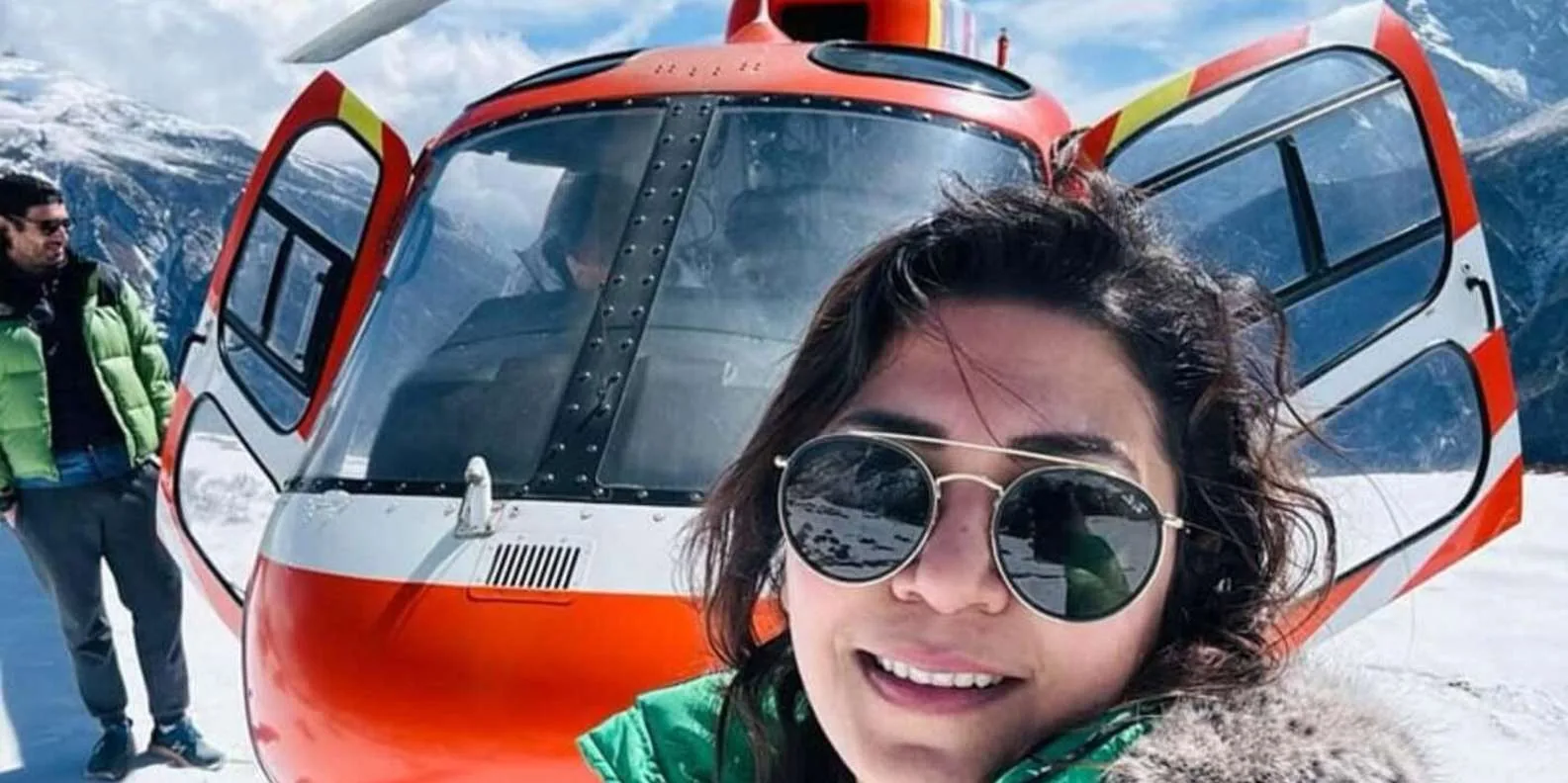
What Can You See on the Everest Helicopter Tour? Every Peak, Valley and Landmark on the Route
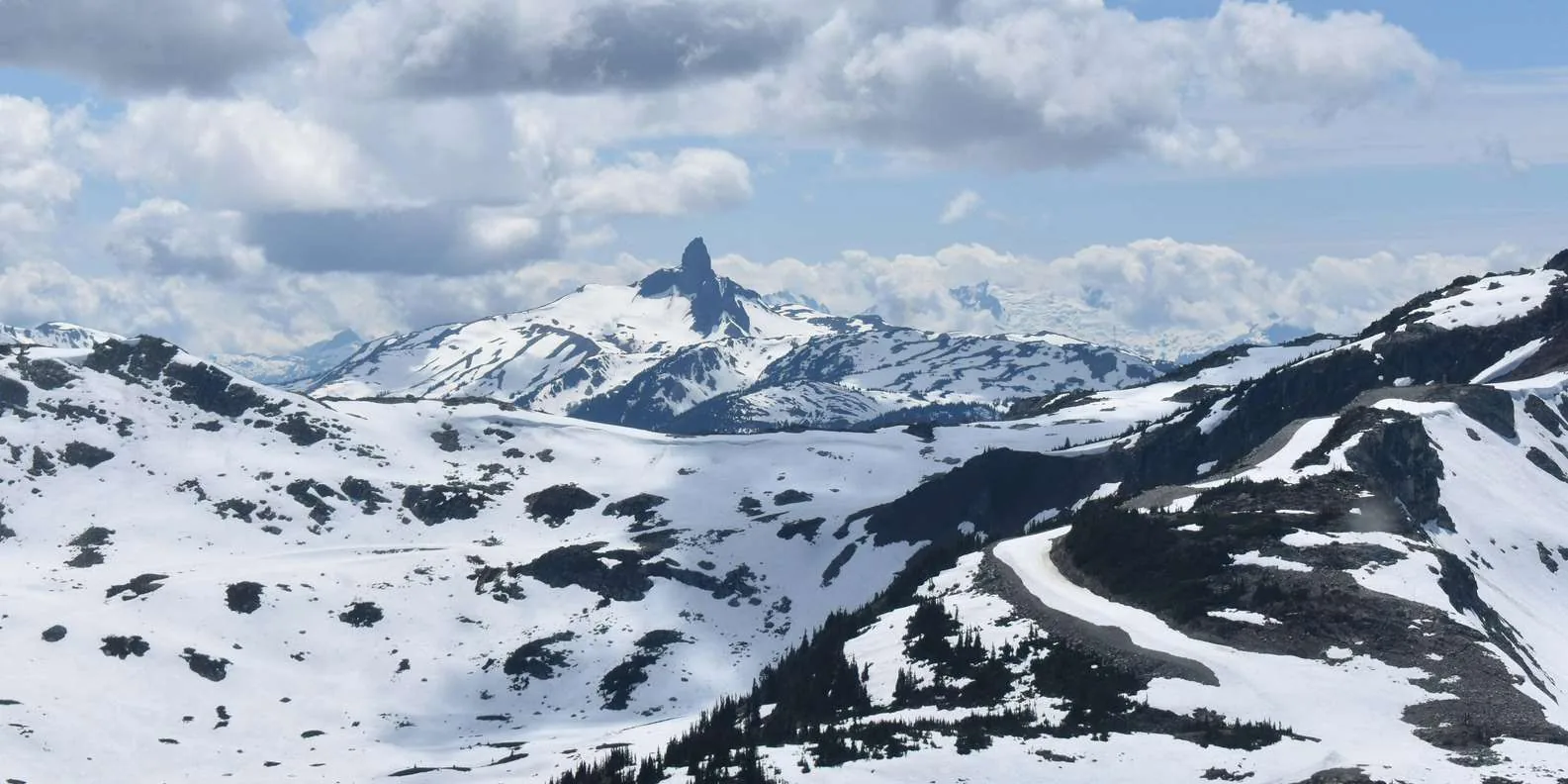
The Everest helicopter tour is often sold as "you'll see Everest" — as if one mountain floats alone in the sky. The truth is better: the hour-and-a-half flight from Kathmandu to Base Camp crosses the most densely spectacular mountain scenery on Earth. This guide walks the full route, window by window, so you know exactly what appears on each leg — which peaks, which villages, which landmarks, and what you actually stand among when the aircraft lands.
- $1,260Everest day tour, per seat
- 5,545 mKala Patthar landing
- 6 hrsTypical door-to-door time
- DailyDepartures in season
It is written by the operator, not a copywriter: every sight below is one our crews point out daily. Use it to plan your photography, choose your seat, and know what the pilot means when the headset crackles with a name.
Leg One: Kathmandu to Lukla — The Middle Hills Take Off
The first fifteen minutes are the flight's quiet surprise. The helicopter lifts from Tribhuvan International Airport's domestic helipad and banks northeast, and Kathmandu's brick-and-concrete sprawl drops away into terraced farmland. What you see:
- The Kathmandu Valley rim — the hills that hide the capital, forested ridgelines with small stupas on their crests.
- The Sun Koshi river system — grey-green rivers braiding through deep valleys, the highway to Tibet a thin thread beside them.
- Terraced middle-hill villages — the agricultural Nepal most tourists never see from the air: rice paddies cut into impossible slopes, red-brown in autumn, electric green in monsoon.
- Langtang and Dorje Lakpa on the horizon — the first snow summits of the morning, appearing ahead-left as the middle hills thin out.
Photography note: this leg is the flight's softest light — the sun is still low, the valleys are filled with morning haze that photographs beautifully. Keep the camera ready from wheels-up; the passengers still fiddling with settings miss the best fifteen minutes of the day.
Lukla: The Tenzing-Hillary Airport
Every Everest tour stops here for fuel, and the stop is a sight in itself. Lukla's airport (2,860 m) is the famous one: a 527-metre runway sloped at 12 percent, carved into a hillside, with a stone wall at the top end and a cliff at the bottom. Fixed-wing pilots land uphill and take off downhill. From the helicopter you see it at eye level on approach — most passengers consider it the flight's second-most-photogenic moment after Everest itself.
The village of Lukla wraps the runway's south side: tin roofs, prayer flags, the trailhead arch that marks the start of every Base Camp trek in history. Your ground time here is short — ten to fifteen minutes while the crew refuel — enough to walk the fence line, feel the altitude's first breath (Lukla is already higher than any Alpine ski resort), and watch the Yeti Air Twin Otters perform their sloped take-offs.
Leg Two: The Dudh Koshi to Namche — The Sherpa Country
From Lukla the helicopter climbs the Dudh Koshi valley — the sacred river that drains the Everest region. This is the flight's most varied leg: villages, forest, canyon, and the first recognisable names for anyone who has read trekking books.
- Phakding and Monjo — the trek's first-night villages, stone lodges strung along the river.
- The Sagarmatha National Park gate — the checkpoint where trekkers show permits, a suspension bridge below it.
- Namche Bazaar (3,440 m) — the amphitheatre village. From the air you see why every photo of it looks the same: it is a near-perfect horseshoe of Sherpa houses built into a bowl. The Saturday market's blue tarps are visible on market days.
- Kongde and Thamserku — the ridge and the 6,608 m peak that flank Namche; Kongde's ridgeline carries the highest hotel viewpoint you will pass before Syangboche.
- Tengboche Monastery (3,860 m) — the region's spiritual centre on a ridge-top clearing, its gilded roof the one man-made glint in a forested sea. If you have read anything about Everest expeditions, this is where the lamas bless them.
- The treeline ends — above Tengboche, forest gives way to juniper scrub, then to bare rock and ice. Passengers who understand what they are watching describe this minute as the moment the flight changes character.
Leg Three: The High Khumbu — Where the Giants Stand
From Pangboche onward the flight enters the landscape people book it for. The valley walls steepen, the glacier appears, and the named giants arrive in sequence. Here is the window-by-window order:
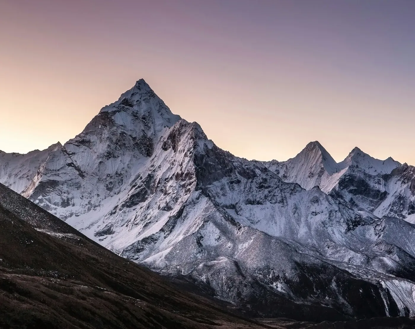
- Ama Dablam (6,812 m) — the flight's superstar. The perfect snow pyramid with the hanging glacier ("dablam") on its southwest face. From the left windows it fills the frame for two full minutes. If you photograph one mountain other than Everest, this is the one — it is more photogenic than Everest itself and every professional on board knows it.
- The Khumbu Glacier — the grey river of ice flowing from the Western Cwm, its moraine walls like levees, the icefalls churned white where it drops.
- Nuptse (7,861 m) — not one peak but a five-kilometre wall, the long ridge that hides Everest from the south until the last moment.
- Lhotse (8,516 m) — the world's fourth-highest, sharing Everest's massif; the two are siblings above 8,000 m.
- Pumori (7,161 m) — "Everest's Daughter", the pyramid directly opposite Kala Patthar; you will land in her shadow.
- Everest (8,848.9 m) — the summit appears last and closest, the south face and the summit pyramid with the Hillary Step's ridge line. When the pilot says "there it is", the cabin goes silent. It is not the biggest sight of the flight — it is the deepest.
- Everest Base Camp (5,364 m) — in spring and autumn, the coloured tents of climbing expeditions are visible on the glacier's edge, the small beginning of every summit attempt in history.
The Landing: What You Stand Among at Kala Patthar and Base Camp
The landing is where the helicopter tour stops being a flight and becomes a place you were. At Kala Patthar (5,545 m) the aircraft sets down on the black-rock ridge opposite Everest's southwest face. Step out and the scene is: the summit pyramid dead ahead at eye level across the glacier, Pumori's shadow reaching toward you, the Western Cwm a white highway between, prayer flags left by earlier groups snapping in the wind. The ground time is ten to fifteen minutes — enough for the photos, not enough to get cold.
At Everest Base Camp (5,364 m) — when the pilot sets down there instead — you stand on the Khumbu Glacier's moraine among the expedition tents, the icefall directly above, Everest hidden behind its own ridge (this is the truth: from Base Camp itself you cannot see the summit; from Kala Patthar you can — a fact that decides which landing photographers prefer).
The Breakfast Stop: Everest View Hotel, Syangboche (3,880 m)
The descent to the Everest View Hotel is the tour's decompression chamber. The hotel sits on the Syangboche ridge above Namche, built in 1971 with a single design rule: every table faces Everest. From the dining room the panorama runs Nuptse to Lhotse to Ama Dablam — a 180-degree wall of snow with breakfast in the foreground. The hot food, the oxygen-thick 3,880 m air, and the first chance to review photos make this the stop passengers rank second. It is also the photo spot for the classic "breakfast with Everest" shot that fills Instagram — the windows do the composition for you.
The Return Leg: What You See Flying Back
The return retraces the corridor with two hours more light and the mountains on the other side of the aircraft. Ama Dablam now belongs to the right windows; Namche's bowl appears from a different angle; the Dudh Koshi runs silver instead of grey. In autumn the afternoon light is warmer and flatter than the morning's — landscape photographers say the outbound leg is for the peaks and the return leg is for the valleys. Watch for the Lukla take-off one more time, then the middle hills close the show as they opened it.
The Complete Sight List — Checklist Version
| Leg | Peaks | Landmarks |
|---|---|---|
| Kathmandu → Lukla | Langtang, Dorje Lakpa (horizon) | Valley rim, Sun Koshi, terraced villages |
| Lukla stop | — | Tenzing-Hillary sloped runway, trailhead arch |
| Dudh Koshi corridor | Kongde, Thamserku, Ama Dablam | Phakding, Monjo, park gate, Namche Bazaar, Tengboche |
| High Khumbu | Pumori, Nuptse, Lhotse, Everest | Khumbu Glacier, Base Camp tents, icefall |
| Landing (Kala Patthar / EBC) | Everest face, Pumori | Prayer flags, expedition camp, Western Cwm |
| Breakfast stop | Nuptse, Lhotse, Ama Dablam | Everest View Hotel, Syangboche ridge |
| Return | All, reversed light | Lukla, valley villages, middle hills |
Which Seat Sees What
The H125 seats five: two front (beside the pilot), three rear. All five see everything — the aircraft banks both directions through the corridor, and the pilot circles the key summits so both sides get their window. The front seats give the cockpit perspective (Everest with the instrument panel in the foreground — the photo the pilot takes for you); the rear three share the widest uninterrupted view. On the high landing, everyone exits — the seat matters for the flight, not the ground time.
What You Will NOT See — The Honest List
Three things the flight does not show, so you can plan honestly: the summit of Everest from Base Camp itself (hidden by the ridge — Kala Patthar is the viewpoint, which is why it is our standard landing); the north (Tibet) side of Everest — the tour stays on the Nepal side throughout; and Gokyo's lakes — a different valley east of the corridor, which needs its own tour. If any of those is the specific photograph you are chasing, tell us at booking and we will route the right product for it.
Photography Notes from 10 Years of Flying This Route
Bring the camera you can operate with gloves on. Burst mode beats single frames through vibrating glass; a polarizer cuts the window glare and deepens the blue at altitude; and phone cameras handle Everest light better than they have any right to. The two shots everyone regrets missing: Ama Dablam on the outbound (two minutes, unrepeatable light) and the Lukla runway on approach. The two shots nobody misses: the landing itself (you have fifteen minutes on the ground) and the Everest View Hotel window (the hotel is literally designed for it).
The what-to-wear guide covers the clothing side of the same morning; the cost breakdown article covers the numbers. For the flight itself, this page is the map — the only thing left is a clear morning. And if you are still deciding between this tour and the fixed-wing scenic flight, our scenic flight vs helicopter comparison walks the decision honestly.
The Seasons Change What You See
The route is the same every morning; the theatre changes with the calendar. Autumn (September-November) is the post-monsoon clarity season: air washed clean, the peaks at their sharpest, the middle hills still green from the rains. This is the photographer's window — but also the busiest, and the corridors carry more aircraft. Spring (March-May) brings the climbing season's energy: Base Camp is a tented city, the icefall is laddered with expedition ropes, and the light runs warmer and softer. Winter (December-February) is the connoisseur's flight: the sharpest air of the year, empty skies, and snow lines at their lowest — but the cold at the landing is real (-10°C and below) and morning fog in the valleys occasionally delays departures. The monsoon (June-September) flips the whole experience: clouds own the high country, flights operate in weather windows rather than schedules, and the sights that appear between buildups feel like secrets. Our cancellation policy exists because the mountain, not the calendar, decides what you see.
Air Window Etiquette: Sharing the Corridor
One thing the flight reveals that ground travellers never learn: the Khumbu has traffic. On a clear October morning the corridor carries helicopters up and fixed-wing flights below, and the radio chatter between pilots — weather reports from Pheriche, wind at Kala Patthar, a medevac priority — is the invisible choreography that keeps it all safe. Our pilots hold altitudes, stagger the corridor, and give way to rescue traffic as a hard rule: the same aircraft that flies your tour flies the region's evacuations, and the priority is never questioned. It is worth knowing as a passenger: if your flight pauses in a hover or circles a monastery ridge while another aircraft passes, that is not a delay — it is the system working exactly as it should, and the pause usually comes with the best unplanned photo of the morning.
One closing note for the planners: this sight list is why the tour runs at all — the fixed-wing scenic flight shows you the crest from a distance, the trek earns you one valley on foot over two weeks, and the helicopter is the only product that puts you inside the whole theatre in a single morning. When you know what is coming on each leg, the flight stops being a ride and becomes a narrated crossing of the most dramatic geography on Earth. We will see you at the helipad at 06:00.
For reference, Everest (8,848.86 m) is the authoritative background on this feature.
Read these next: Everest Base Camp Helicopter Day Tour: Cost, Landing & How to…, Everest Base Camp Helicopter Trek Cost 2026 — Trek Up, Fly Back…, and How Much Does an Everest Helicopter Tour Cost in 2026?.
Frequently Asked Questions
Do you see Mount Everest itself on the tour?
Yes — the summit, the southwest face, and the summit pyramid at eye level from Kala Patthar, plus the full approach flight past the massif. From Base Camp itself the summit is hidden behind Nuptse's ridge; Kala Patthar is the viewpoint, which is why it is our standard landing.
You can check live 2026 pricing and departure dates on our Everest Base Camp helicopter tour page.What is the single best sight on the flight?
Passengers split into three camps: the Everest moment (the summit appears past Nuptse), Ama Dablam (the perfect pyramid, most photogenic mountain on the route), and the landing itself (standing at 5,545 m). All three happen on every flight — the order above tells you when to be ready for each.
Can I see Everest Base Camp tents from the air?
In the spring (April-May) and autumn (September-October) climbing seasons, yes — the expedition tents are visible on the glacier's edge at the foot of the icefall. Outside the seasons, Base Camp is a rock-and-ice landscape; the landing zone and prayer flags mark it.
Which side of the helicopter is better for photos?
Both — the pilot banks both directions and circles the key summits. The front seats give the cockpit-window composition; the rear bench gives the widest uninterrupted panorama. Everyone exits at the landing, and the ground time is the real photo session.
Do you fly over or near any villages?
The corridor passes directly over the trekking villages — Phakding, Monjo, Namche Bazaar, Tengboche — at sightseeing altitude. You see Sherpa country as it actually is: lodges, prayer walls, dzo in the fields, monastery roofs. It is the part of the tour passengers consistently underrate in their planning and overrate in their memories.
Is anything on the route visible from Kathmandu on a clear day?
On the clearest autumn and spring mornings, the Langtang range is visible from Kathmandu's rooftop bars — but Everest never is; it is 160 km away and behind the Mahalangur wall. The helicopter tour is the only way the summit enters your view from the capital in a single morning.