
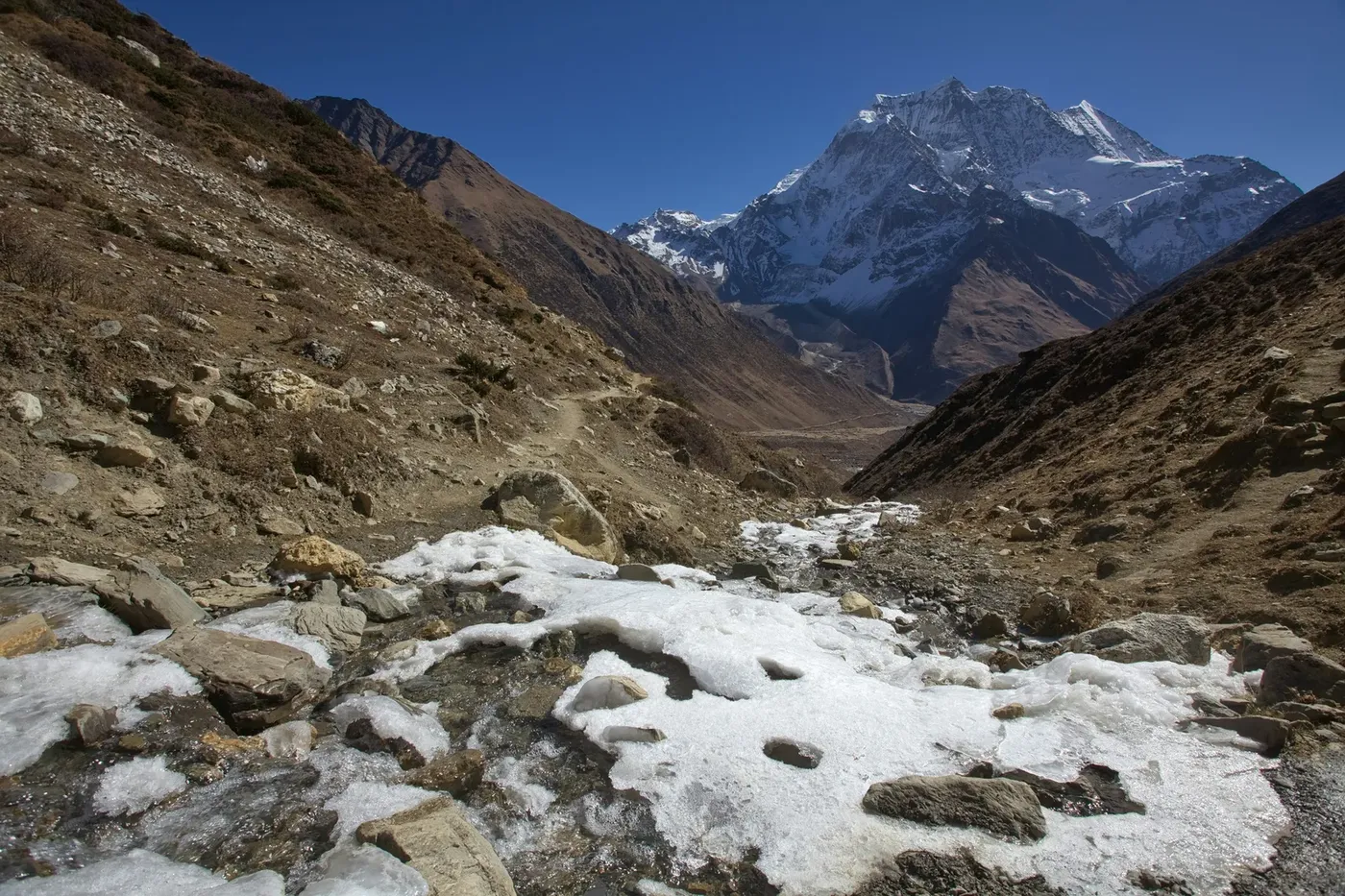
Short answer: The Manaslu Circuit Trek is a 13-day loop through Nepal's Manaslu Conservation Area that crosses the Larkya La Pass (5,160 m) below the world's 8th highest mountain, and our helicopter-return version replaces the three-to-four day walk-out from the pass with a single flight from the Dharpani side. The route runs Kathmandu to Pokhara to the start of the trail, up the Budhi Gandaki gorge and across the Larkya La, with the option to walk down to Pokhara on the other side. Cost is $2,160 per person on a shared flight, and the restricted-area permission is arranged in Kathmandu before departure.
- 13 daysKathmandu to Kathmandu
- 5,160 mLarkya La, the high point
- $2,160Per person, shared flight
- Sep–Nov, Mar–AprTrek season, peak in October
Where Is Manaslu, and Why Does the Circuit Start in Kathmandu?
Manaslu in Nepal is the world's 8th highest mountain at 8,163 m, rising north of Pokhara on the western edge of the Annapurna massif, near the Tibetan border. It is also a controlled mountain: the Manaslu Conservation Area and the special restricted-area permission are required before anyone walks the full circuit, and that permission is what limits who may walk it.
The trek starts in Kathmandu because there is no airstrip in the Manaslu region. It is a road-and-trail route: drive to Pokhara, then on to the start of the trail at the mouth of the Budhi Gandaki valley, up the gorge, over the Larkya La, and down the far side into the road network near Pokhara. The circuit runs one way only, which is why the map shape matters.
So a "manaslu circuit trek map" is really two shapes. On paper it is a rough horseshoe — the long arm of the Budhi Gandaki gorge on one side, the Larkya La at the top, the shorter Dharpani descent on the other. On the ground it is days of green forest, then days of barren high valley, then one enormous morning on a pass at 5,160 m, then a descent that takes most groups three to four more days on foot. That last stretch is the one most people would rather fly.
The Manaslu Circuit Trek Route, Stage by Stage
This Manaslu Circuit Trek guide follows the route in the order you walk it. The opening days are road: Kathmandu to Pokhara, then on to the trailhead, the ground rising as tarmac gives way to dirt and then to nothing. From there the trail enters the Budhi Gandaki, a gorge so narrow in places that the river is the only way through, with villages on terraces above the water.
Midway through, the valley changes character. The gorge walls open, the trail climbs onto a high, dry, Tibetan-influenced plateau, and you pass through Lho and Samagaun, the last two villages before the crossing. Above them the route crosses yak pasture and glacier approach, then the pass at 5,160 m, the highest point of the trek. On the far side it drops into a glacial valley and reaches the Dharpani side, above Bimthang at 3,590 m, where the walking rejoins the road and the helicopter can lift you out. Do not confuse it with Dharapani, the 1,860 m roadhead at the far end of the walk-out.
Reading the Manaslu Circuit Trek Map in Words
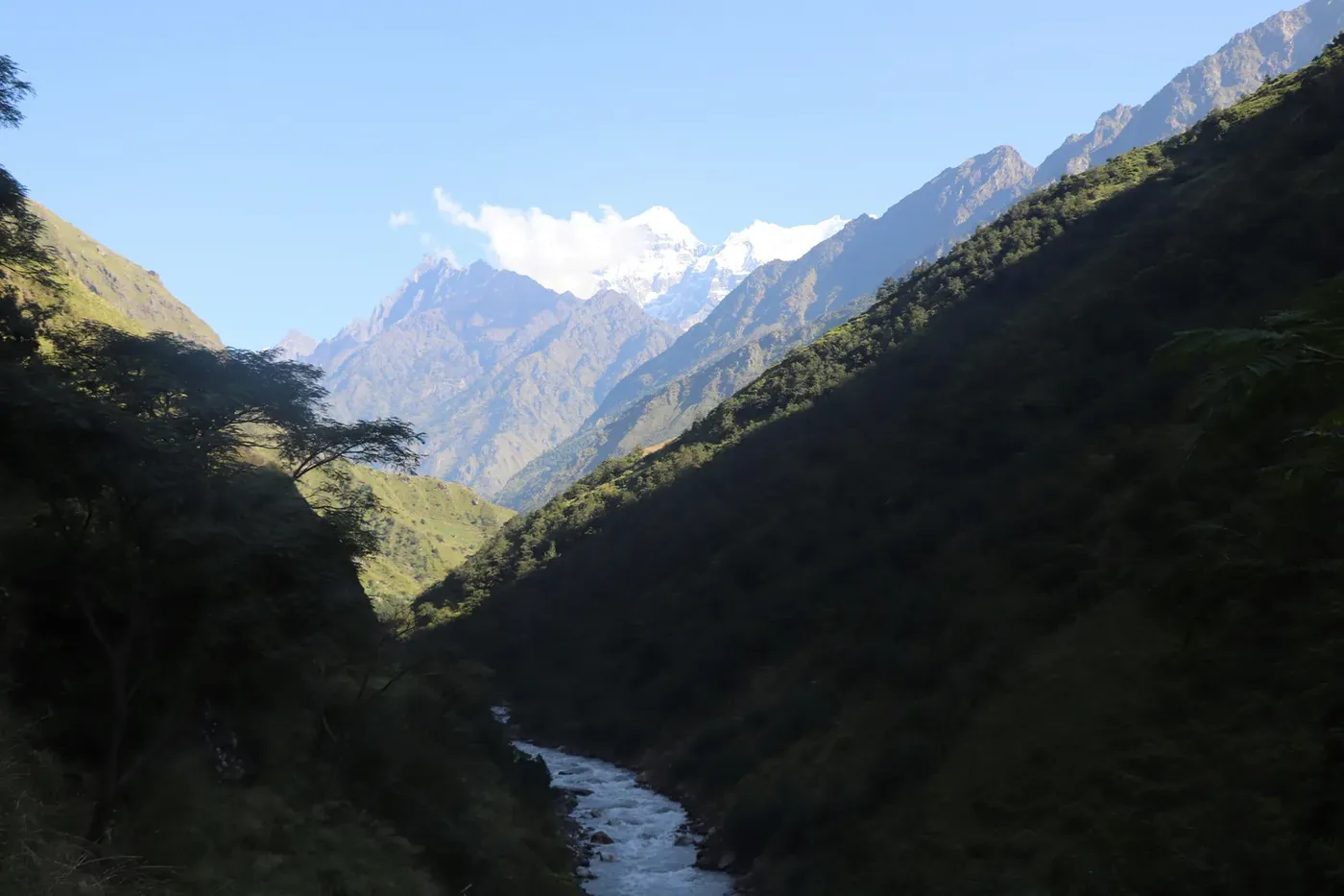
If you have never been in the region, the map is the hardest part of the plan, because the names are unfamiliar and the shape unusual. South to north, it reads like this. Up the Budhi Gandaki, the river cuts north out of the Pokhara basin through a series of gorges and the trail follows it, crossing on swaying suspension bridges. The villages are green, subtropical and busy. The gorge is why the trek is graded challenging: you climb out of it, and keep climbing.
The high plateau and the pass. The trail leaves the river, crosses open pasture and arrives at Lho and Samagaun, the villages closest to the pass. From there it runs across high ground to the Larkya La at 5,160 m, and the landscape turns from inhabited to empty. Beyond the pass it falls away steeply into the Dharpani side, where the walk-out continues if the flight cannot go. The road legs bracket it: Kathmandu 1,400 m, Pokhara 822 m.
What Is Lho, and What Is Samagaun in Nepal?
Lho is a village on the upper Budhi Gandaki, a short walk before Samagaun, and one of the last settlements before the crossing. It is a high, exposed place — stone and timber buildings on an open shelf, the valley dropping away on one side and the pass waiting above. Lho is known for the large monastery above the village, a genuine Tibetan Buddhist settlement rather than a resort, so trekkers are asked to walk quietly through.
Samagaun is the larger of the two, and the last properly inhabited village before the crossing. The walk from Lho to Samagaun is short in distance but significant in what it tells you: the houses get fewer, the lodges get simpler, the yak pastures start, and the high ground towards the pass comes into view. Samagaun in Nepal is where most groups take their rest day, and the practical point of no return — beyond it, the weather window decides the day.
Manaslu Base Camp: How Close You Get to the Eighth-Highest Peak
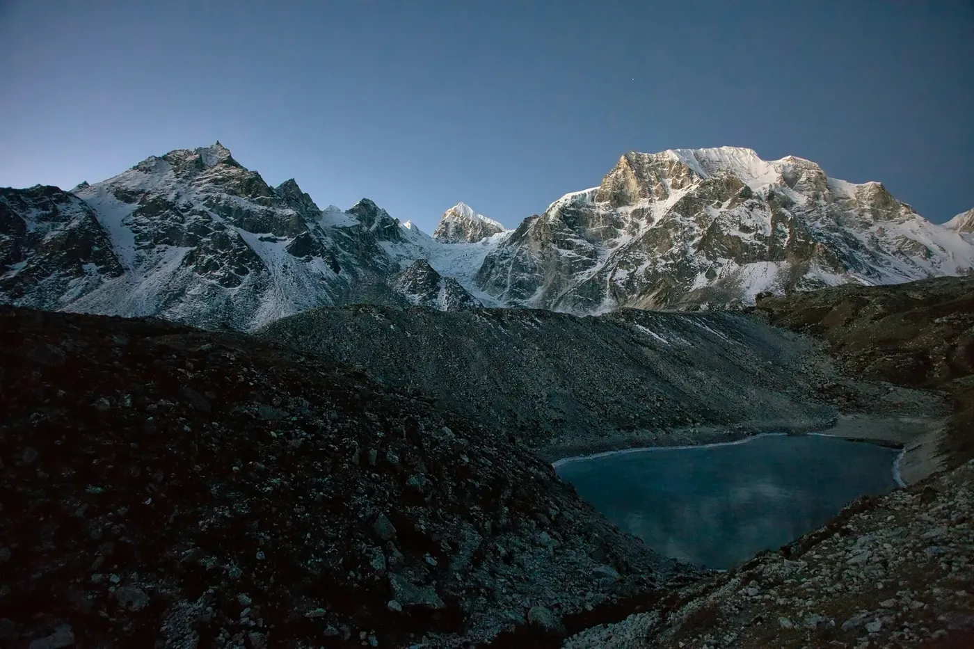
Manaslu Base Camp is where the mountain stops being a photograph and becomes a wall. The camp sits on the Manaslu Glacier below the summit ridge, and on a clear morning the face above fills the width of the sky: the 8,163 m peak and the ridges of the massif, seen from the ice at its foot. It is a cold, serious place, with expedition tents and climbers' gear.
Reaching it is a full day of walking from Samagaun, and it is the standard goal of the rest day. Not everybody takes it, because the alternative is the quieter walk to Pungyen Gompa, an old monastery with a wide view towards the twin peaks above the pass. None of that is Manaslu summit — nobody walks to the top of an 8,000-metre mountain — so the base camp gives scale, not a summit.
The Manaslu Restricted Area Permit: Who Can Walk the Full Circuit
This is the part of the Manaslu circuit people get wrong, so it is worth stating plainly. Two permissions are needed before you walk: the Manaslu Conservation Area permit, and the special restricted-area permission, which is the document that actually opens the circuit. That permission is what limits who may walk the full Manaslu circuit, and it is issued through a registered agency with a licensed guide — the guide is not optional, it is a condition.
Operationally that is good news. You are not assembling documents yourself in Kathmandu on a Sunday afternoon. Both permits are arranged before departure, in Kathmandu, by the operator running the trek, and the conservation levy that funds the region sits inside the permit block, so it is already in the price quoted to you. What the permission does not do is make the route easy. It gates access to a remote circuit, which is why the Manaslu region still feels emptier than Everest or Annapurna even in the main season. Our route, inclusions and permit block are on the Manaslu Helicopter Return Trek page, and the cost breakdown goes into the numbers line by line.
The Manaslu Trek With Helicopter Return: Trek the Circuit, Fly Out of It
A standard Manaslu Circuit finishes on foot, and the walk-out from the Larkya La is three to four days of descent. It is the least enjoyable stretch of an otherwise excellent trek: the best scenery is behind you at the pass, the trail is long and eroded, and the weather that produced the view is the same weather deciding how you get down. Add three to four more days of exposure in the weeks when the monsoon-prone weather closes in, and the arithmetic stops being romantic. The helicopter exit takes the same route and replaces those descent days with one flight.
The flight is from the Dharpani side, after the crossing. It is weather-dependent, and it must be confirmed on the morning it happens — not the evening before, not the week before. If the window is not there, the flight moves to the next suitable morning. That is the honest version of the promise, and it is why the walk-out is always the fallback: on paper it is a helicopter, on the ground, if the sky does not cooperate, you walk down.
On the practical side, that single flight replaces the roughest lodges, the longest days, and the stretch that most reliably wrecks people's knees. It also means your international travel needs no buffer days. Our guide to how helicopter rescue and evacuation works in Nepal covers the aircraft and the ground handling, and our note on the Budhi Gandaki flood is worth reading if you are weighing the monsoon.
Manaslu Trek Days: A 13-Day Itinerary
Thirteen days, start to finish, and the shape is fixed: road days at the front, the middle walking up the Budhi Gandaki and across the high plateau, the pass in the second week, and a tail that depends on the weather. It is a challenging grade — long days in the gorge, a cold start on the pass — and prior multi-day trekking experience is recommended.
| Day | Stage | What the day looks like |
|---|---|---|
| 1 | Kathmandu to Pokhara, then the trailhead | Road into the Budhi Gandaki |
| 2 | Machha Khola and Jagat | Cross the Fish River, enter the restricted area |
| 3 | Salleri, Sirdibas, Deng | Sub-tropical to temperate forest |
| 4 | Namrung | Mani walls, rhododendron, Ganesh Himal views |
| 5 | Lho, then Shyala | Exposed village, monastery, circle of peaks |
| 6 | Samagaun | Last inhabited village, rest day |
| 7 | Base Camp or Pungyen Gompa | Rest day below the 8,163 m massif |
| 8 | Samdo | Yak pastures, near the Tibetan border |
| 9 | High pass on the Nepal–Tibet border | Old salt-and-wool trade route |
| 10 | Dharmasala, the pass camp | Last wooden bridge, early night |
| 11 | Larkya La | 5,160 m, the high point, then a steep descent |
| 12 | Bimthang and down to the Dharpani side | Above Bimthang 3,590 m, the helicopter exit point |
| 13 | Dharpani to Kathmandu | Road out, or the flight to Kathmandu |
Read the middle of that table again: gorge days, then the plateau, then the pass, and the exit on the far side. It is a proper trek with a proper acclimatisation profile, and the helicopter touches none of it. It only replaces the tail.
Manaslu vs Everest vs Annapurna: The Three Helicopter-Return Treks
We run three helicopter-return treks. The choice is about altitude, length and how remote you want to be. All three walk the classic route and fly only for the way out.
| Trek | Days | Max altitude | Price per person, shared flight |
|---|---|---|---|
| Manaslu Helicopter Return Trek | 13 | 5,160 m | $2,160 |
| Everest Base Camp Helicopter Trek | 10 | 5,545 m | $1,840 |
| Annapurna Helicopter Return Trek | 6 | 4,130 m | $1,199 |
Everest is the highest and the most famous, and has the traffic to match. Annapurna is the shortest and the gentlest. Manaslu is the longest, the most expensive and the most remote, and the flight out of it saves the most walking. The other two itineraries are on the Everest Base Camp Helicopter Trek and Annapurna Helicopter Return Trek pages, and our helicopter tours hub has the rest.
If you would rather walk the whole circuit out on your own feet, the classic walking version is the same route without the flight, run as walking the classic Manaslu circuit with Enticing Himalaya. That version adds the full walk-out from the pass, and it suits anyone who wants the complete loop.
Best Time for the Manaslu Circuit
The trek runs September to November and March to April, with the main season in October. Those windows are the answer for a reason: the Manaslu region is one of the wettest parts of the Himalaya, and the circuit sits on the wrong side of the monsoon. Late September and October give the clearest skies over the pass and the most stable flight mornings. November is drier and colder but still inside the window. March and April are workable, with firmer trails, but colder mornings and a higher chance of a delayed flight.
Because the exit is a helicopter, book for the stability of the flight window, not only the temperature. Our month-by-month guide to the best time for helicopter touring in Nepal sets out the regional trade-offs.
Cost and How to Book
The Manaslu Helicopter Return Trek is $2,160 per person on a shared flight. The price covers the restricted-area permission and Conservation Area permit, the mandatory licensed guide, lodge and meals on the trail, the Kathmandu to Pokhara ground transfers, and the helicopter exit from the Dharpani side.
Booking is deliberately simple. You send an enquiry, we confirm the departure date, the price per person and exactly what the helicopter exit includes in writing, and you pay nothing online. On weather cancellations you get a full refund or a free rebooking. We are a government-licensed operator based in Thamel, Kathmandu, running trips out of Nepal since 2012. The enquiry process is in our guide to how to book a helicopter tour in Nepal, the terms in our cancellation policy.
Two practical notes. Hold a spare day after the trek if your international flight is tight, because the exit flight is confirmed on the morning and can move to the next window. And buy insurance that explicitly covers helicopter evacuation at altitude before you go — our note on helicopter tour safety and insurance in Nepal explains why a standard policy is not enough.
Frequently Asked Questions
How many days is the Manaslu Circuit Trek?
Thirteen days for our Manaslu Helicopter Return Trek, Kathmandu to Kathmandu: the road legs to Pokhara and out to the trailhead, the walk up the Budhi Gandaki gorge, the Larkya La crossing at 5,160 m, and the helicopter exit. The walking circuit is longer because it adds the three-to-four day walk-out.
How much does a Manaslu Circuit Trek with helicopter return cost?
$2,160 per person on a shared flight, including the restricted-area permission, the Conservation Area permit, the mandatory licensed guide, lodge and meals on the trail, the ground transfers, and the helicopter flight out after the Larkya La.
Do I need the Manaslu restricted area permit, and can I get it myself?
Yes, and you should not try to do it yourself. Both the Conservation Area permit and the special restricted-area permission are required before anyone walks the full circuit, and the restricted-area permission is issued through a registered agency with a licensed guide — a condition, not a preference. The operator arranges both in Kathmandu before departure, and the permit costs sit inside the quoted price.
Where is Manaslu and how do you reach the Manaslu Circuit trailhead?
Manaslu is in Nepal's north-central Himalaya, north of Pokhara on the western edge of the Annapurna massif, near the Tibetan border. You get there by road: Kathmandu to Pokhara, then on to the trailhead at the mouth of the Budhi Gandaki valley. With no airstrip in the region, the opening days are road days.
What is Lho on the Manaslu Circuit?
Lho is a high, exposed village on the upper Budhi Gandaki, one of the last two settlements before the crossing, known for the large monastery above it. It is a genuine Tibetan Buddhist village rather than a tourist stop, so trekkers are asked to walk quietly through. It sits just before Samagaun.
What is Samagaun in Nepal on the Manaslu circuit?
Samagaun is the larger of the two villages closest to the Larkya La, and the last properly inhabited village before the crossing. It is where most groups take their rest day, either walking to Manaslu Base Camp or to Pungyen Gompa monastery. Above it the route crosses open yak pasture, and the weather window for the pass decides the day.
How do you reach Manaslu Base Camp?
On foot from Samagaun, on the rest day in the middle of the circuit. It is a full day up to the Manaslu Glacier, where the 8,163 m face fills the skyline and the expedition tents sit on the ice below. It is a cold, serious place, and nobody walks to the summit of an 8,000-metre mountain. The gentler option is Pungyen Gompa monastery.
Can you do a Manaslu trek with a helicopter return instead of walking out?
That is the whole point of the product. You walk the full circuit, cross the Larkya La at 5,160 m on foot, and fly out from the Dharpani side instead of walking three to four days down. The flight is weather-dependent and confirmed on the morning, with the walk-out always kept as the fallback.
When is the best time to trek Manaslu?
September to November and March to April, with October the peak of the main season. The region is one of the wettest parts of the Himalaya, so the monsoon months are the problem rather than winter. October gives the clearest skies over the pass and the most stable flight mornings.
What happens if the weather closes the helicopter flight out of Manaslu?
The flight moves to the next suitable morning window, and the walk-out to Pokhara stays on the table, so you are never stranded. On a weather cancellation by the operator you get a full refund or a free rebooking, and you should hold a spare day after the trek in case the flight moves.
The Bottom Line
The Manaslu Circuit Trek is the most remote of Nepal's big treks and the one with the paperwork to match: 13 days, a maximum of 5,160 m at the Larkya La, a restricted-area permission arranged in Kathmandu, and $2,160 per person on a shared flight. What you get is the emptiest version of the Nepali Himalaya — the Budhi Gandaki gorge, the high plateau around Lho and Samagaun, the glacier below the eighth-highest mountain, and a pass crossing with the Tibetan border ahead of you.
And then you fly out of it: the same trail, the same pass, without the three-to-four day descent and the weather risk that comes with it. If you want the classic loop walked end to end instead, the walking version is the same route without the flight, and we run that too. The mountain itself, and the numbers that go with it, are in the reference entry for Manaslu — worth reading before you plan.