
As of the evening of Sunday 11 October 2026: a flash flood on the Budhi Gandaki river in Gorkha swept away at least three bridges and dozens of riverside houses in Chumnubri and Dharche rural municipalities, and four local people remain unaccounted for. This is the same corridor the Manaslu Circuit and the Tsum Valley approach use. Nepali Army teams reached the area by helicopter and airlifted six people from Jagat. No official reopening statement had been issued for the lower trail, so the Manaslu Circuit should not be treated as walkable on its standard lower itinerary until local authorities confirm otherwise. This page is dated and will be updated as confirmed information changes.
- 3+Bridges swept away
- 4People unaccounted for
- 6Airlifted from Jagat
- 11 OctDate of the flood
What happened on the Budhi Gandaki on 11 October 2026
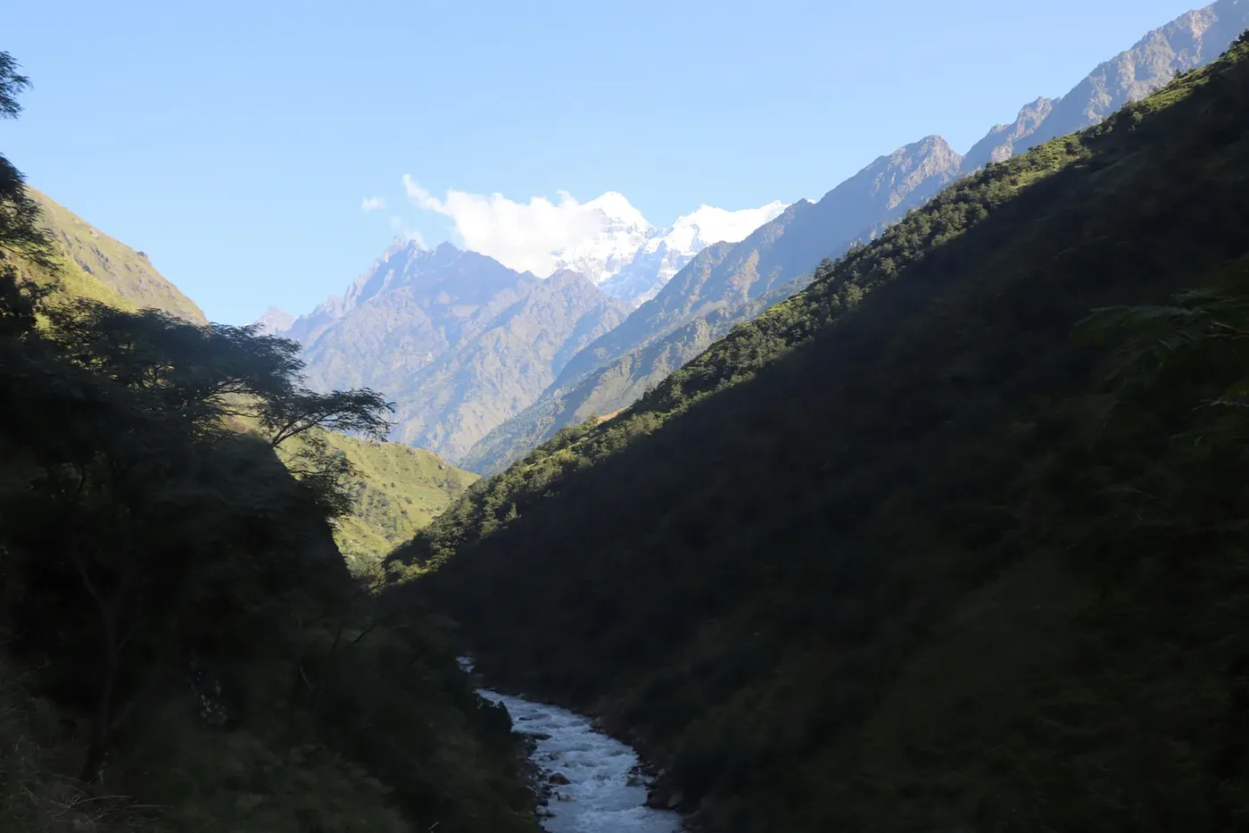
Early on Sunday morning, a flash flood tore down the Budhi Gandaki river in Gorkha district. Residents and tourists began moving to higher ground from around 4am after hearing loud roaring from the Ugyulung and Syar rivers, according to reporting by the Kathmandu Post. Water levels continued to fluctuate through the morning rather than settling, which is typical of a debris-dammed river that blocks and bursts repeatedly.
Police said the flood followed a landslide that blocked the river between Lokpa and Chumling in Chumnubri Rural Municipality-6. A separate report from the same district described a landslide near the Ungilung river in Chumchet sending water down the Syar river into the Budhi Gandaki. Officials have not yet established the exact cause, and both explanations describe the same mechanism: a hillside collapses into a tributary, dams it, and then releases.
Gorkha's chief district officer, Dharmendra Kumar Mishra, said preliminary reports indicated a landslide above Sirdibas, and that five to seven houses in the riverbank settlement of Jagat had been swept away. He said no details of casualties had been confirmed at that stage.
Four people are unaccounted for. They had been living in a shed on the banks of the Ungilung river in Chumchet, Chumnubri-6. A local resident, Sherap Gurung, told the Kathmandu Post that villagers had gone to search but could not find the shed. As of publication, no deaths had been officially confirmed.
Which bridges and settlements were affected
For trekkers, bridge status matters more than anything else on this page. The Manaslu Circuit is a one-way teahouse route that follows the Budhi Gandaki upstream for its first several days, crossing suspension footbridges repeatedly. Lose the bridges and the lower route is severed, regardless of how intact the trail surface is.
| Location | What was lost or at risk |
|---|---|
| Nyakchet – Sirdibas, Chumnubri-3 | Old suspension footbridge swept away |
| Nyakchet – Philim Bazar | Bridge destroyed, per Home Minister Sudan Gurung |
| Machhakhola (Dharche-5) – Kerauja | Suspension footbridge swept away; water entered five to seven houses and a similar number of sheds in the lower settlement |
| Soti, Aarughat Rural Municipality 2–3 | Steel motorable bridge swept away |
| Arughat (Gorkha–Dhading link) | Bridge swept away; riverside residents moved to safer ground |
| Salleri, Paiyun and Jagat Bagar | More than 10 houses swept away, per the Chumnubri-3 ward chair |
| Salleri, Dharche-3 | Twenty to 22 houses reported at risk |
| Ghattikhola, Chumnubri ward 3 | Houses swept away |
| Sirdibas | Mud house belonging to Ram Bahadur Gurung swept away; water entered a second house |
| Salleri, Chumnubri-3 (hydropower site) | Construction camp and equipment for the 341 MW Budhi Gandaki hydropower project swept away |
Two things stand out in that list. The first is that the damage is concentrated on exactly the stretch trekkers walk on days two to five out of Machhakhola. The second is that Nyakchet, Sirdibas, Philim, Machhakhola and Jagat are not remote side valleys — they are the Manaslu Circuit's own villages.
Is the Manaslu Circuit open right now?
The honest answer is that nobody can certify the lower route as open as of 11 October 2026. The district administration had not issued a definitive assessment of every section when the first reports were filed, and officials explicitly said the full extent of the damage was still being established. Police were moving through settlements with loudspeakers warning riverside residents to relocate, and the Home Minister warned of the risk of further severe flooding.
If you are searching for a simple yes or no, treat the absence of an official all-clear as a no. A trail is not open because water has receded; it is open when the bridges exist, the slopes above the trail have stopped moving, and the local administration says so.
This matters because the region has already had a difficult autumn. On 6 September a flash flood near Namrung damaged infrastructure and washed away two bridges, and trekking along the Manaslu and Larke Pass route was temporarily suspended. The Nepal Tourism Board reported on 11 September that the damaged structures near Namrung had been restored sufficiently for trekking and lifted that restriction. On 27 September a landslide above Samagaun alarmed trekkers and climbers in the village. As recently as 6 October, repair crews were still working on monsoon damage along the Manaslu trail.
The lesson from that sequence is that a reopening announced last month tells you nothing about the route's condition today. Each new weather event resets the question.
Is the Tsum Valley also affected?
Tsum Valley branches north from the main circuit at Lokpa, and shares the Budhi Gandaki approach with it. The flood's identified source — the landslide between Lokpa and Chumling — sits on that shared approach, and Chumling and Chumchet are Tsum-side settlements.
The upper valley itself, including Mu Gompa and the monasteries around Chhekampar, has not been reported as directly damaged. But access is a different question from damage: if the trail below Lokpa is cut, the valley is effectively unreachable on foot regardless of its internal condition. Tsum Valley is also a restricted area, so permits and a licensed guide are required in any case — see our Manaslu guide for how the restricted-area paperwork works.
Why helicopters matter more in the Manaslu region than almost anywhere in Nepal
This is the part of the country where the absence of an airstrip changes everything. The Khumbu has Lukla. Annapurna has Pokhara and Jomsom. The Manaslu region has neither: the trailhead is reached overland, and there is no runway anywhere on the circuit. If you need to get out fast between Machhakhola and the Larkya La, there is no aircraft to board and no road to walk to. A helicopter is the only fast option, and often the only option at all.
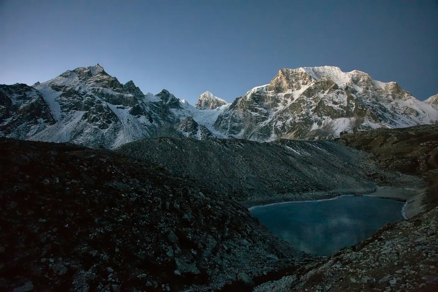
That is also why the events of 11 October produced helicopter news so quickly. The Nepali Army deployed rescue teams to the flood zone and airlifted six people from Jagat. The Home Minister confirmed helicopter teams had been mobilised with other security personnel, and the Prime Minister stated publicly that six people had been rescued by air. Rescue helicopters were also used to move people from the village where Israeli siblings were staying, who were flown to Kathmandu for examination.
The distinction worth understanding is between rescue and evacuation. State rescue is triggered by a disaster and coordinated by the authorities; it is not something an individual trekker books. Commercial helicopter evacuation is what happens when a trekker becomes ill or injured and needs to reach a hospital, and it is arranged through an operator, a guide, or an insurer's assistance line. Both were happening in Gorkha on 11 October, but only the second one is something a future trekker can plan for.
How helicopter evacuation actually works in the Manaslu region
The sequence is consistent across the Himalaya, but the constraints in this valley are tighter than most.
1. The request comes from the trail, not from you
In practice the request originates with your guide, your trekking agency, or a lodge owner with a phone signal. Signal along the Budhi Gandaki is intermittent at the best of times, and damage to infrastructure makes it worse. This is one concrete reason not to trek this route unguided: a solo trekker with no signal and no local network has no way to call for help at all.
2. Medical need is assessed before an aircraft is tasked
Operators and insurers both screen requests, partly to prioritise genuine emergencies and partly because staged evacuations for insurance money are a known problem in Nepal. Expect to describe symptoms, altitude, and location. Severe altitude illness, chest pain, stroke symptoms and trauma are the straightforward cases; ambiguous ones take longer to authorise.
3. The weather decides, and it often says no
October is normally one of the best months to fly in Nepal. But the days after a flood are not normal: valley cloud, rain, and unstable air can close the corridor for hours or days. A helicopter that is authorised and airborne can still turn back. Anyone who tells you a pickup time in advance is guessing.
4. Landing or longline
Manaslu-region pickups generally use a landing near a village or a flat river terrace. Where terrain or a damaged riverbank makes landing impossible, a longline lift may be required — a slower and more demanding operation that narrows the weather window further.
5. Flight to Kathmandu, and hospital handover
From the Manaslu region the destination is almost always Kathmandu, because that is where the hospitals equipped for altitude-related and trauma cases are. That flight runs two to three hours with a fuel stop, not the twenty-minute hop that gets someone off the Khumbu.
What an evacuation from the Manaslu region costs
Published commercial rates for a helicopter evacuation from the Manaslu region to Kathmandu typically fall in the US$4,000–$5,000 range for a one-way flight of two to three hours, with a remote-area surcharge applied because of the distance and the limited alternatives nearby. Our full guide to how rescue and evacuation works in Nepal sets that against every other route in the country, including the far cheaper Khumbu transfers.
Two details drive the price beyond distance. First, the aircraft is usually staged from Kathmandu, so you are paying for the positioning flight as well as the pickup. Second, restricted-area permits mean fewer operators fly here routinely, so there is less competition to hold prices down. If you are comparing quotes, ask what the positioning cost is and whether it is included.
If you are on the trail now, or about to start
The guidance from local authorities and trekking bodies after this flood is straightforward, and worth taking literally:
- Do not attempt to cross a damaged bridge or a swollen river. A suspension bridge that has lost an anchor or a deck is not a shortcut, and the Budhi Gandaki here is fast and cold.
- Avoid the riverbanks, not just the water. Floodwater undermines banks and trail edges. Ground that held last week may not hold now.
- Get a current, stage-by-stage assessment before moving on: from the local administration, your trekking agency, a licensed guide, or lodges in the affected area — not from a post written before the event.
- Expect to change your itinerary, and budget extra days. Repairs on this route have taken weeks, not days.
- Follow official instructions immediately. If police are telling residents to move to higher ground, that instruction applies to trekkers too.
- Keep your itinerary with someone at home and share your guide's or agency's number with them.
If you are in the affected corridor and safe, the most useful thing you can do is make sure your location is known to your agency and to the authorities, and stay put rather than moving through damaged terrain to find a better exit.
Insurance: the clause that decides whether you actually fly
A helicopter evacuation is only useful if someone pays for it, and the payment question is settled before the aircraft is tasked. Two things go wrong repeatedly.
The first is the limit. A policy with a US$5,000 evacuation limit is comfortable for an Annapurna transfer to Pokhara and inadequate for a Manaslu flight to Kathmandu. Check the number against the route you are actually trekking, not against the cheapest evacuation on the market.
The second is altitude. Many policies exclude activity above 4,000 or 5,000 metres, or exclude trekking entirely unless it is named. The Manaslu Circuit crosses the Larkya La above 5,000 metres, so an exclusion written for a beach holiday can void the whole cover precisely where you need it.
Pre-authorisation is the practical step. Insurers do not dispatch aircraft on a promise. Call the assistance line before a flight is needed, get the case number, and make sure your guide has the same number. That is covered in more detail in our insurance guide. And if you are weighing a trek-up, fly-back itinerary, the helicopter return leg is a planned flight rather than an emergency one — see heli trekking in Nepal for how that is arranged.
Emergency contacts in Nepal
These are the numbers worth having saved before you fly, taken from Nepal Police, the Nepal Tourism Board and the Himalayan Rescue Association:
| Service | Number |
|---|---|
| Police (emergency) | 100 |
| Tourist Police (toll-free hotline, English spoken) | 1144 |
| Ambulance | 102 |
| Fire | 101 |
| Nepal Tourism Board | +977-1-5347041 |
| Himalayan Rescue Association, Lazimpat, Kathmandu | 01-4540292 / 01-4540293 |
Note that 1144 is a toll-free hotline and works from a Nepali mobile or landline. The Himalayan Rescue Association operates aid posts and is the standard point of first contact for altitude-illness questions in Nepal; their office number above is the one published on their own site, and it is not the same as the older 444-series number that still circulates online.
If your Manaslu trek is booked for later this autumn
Most people reading this are not in Gorkha. They are holding a booking for November or December and wondering what happens now. A few practical points:
Do not cancel on the basis of today's headlines alone. This corridor has been repaired before — twice already this autumn — and the industry's record on restoring the Manaslu trail is genuinely good. But equally, do not assume your operator will tell you unprompted; ask them directly what their plan is if the lower route is not walkable.
Ask specifically about the helicopter option. Because there is no airstrip in this region, an operator who cannot arrange helicopter access here has fewer fallbacks than one operating in the Khumbu. This is exactly the situation in which a licensed local operator with its own aircraft relationships is worth more than a cheap reseller.
Build in buffer days and check your insurance now, not in November. If your policy excludes trekking above 5,000 metres or caps evacuation at US$5,000, you have time to fix it today and no time to fix it on the trail.
If you would rather talk through your specific dates and route, you can reach us through our contact page, or look at the Manaslu helicopter return trek for a trek-up, fly-back itinerary that includes a planned helicopter leg rather than a contingent one.
How to verify trail status before you commit
Because conditions here change faster than any article can, use primary sources rather than blogs, including this one:
- The Nepal Tourism Board publishes official trekking and restriction notices on its own site.
- The district administration of Gorkha issues local closures and warnings; the chief district officer's office is the authority that matters on the ground.
- TAAN, the Trekking Agencies' Association of Nepal, relays trail status to member agencies — which is why your operator usually knows before it is published.
- The Himalayan Rescue Association is the right contact for altitude and medical questions.
Treat any status claim you read — including ours — as a snapshot with a timestamp. The date at the top of this article is the only thing that tells you whether it is still worth anything.
Frequently Asked Questions
Is the Manaslu Circuit currently open?
As of 11 October 2026 it should not be treated as walkable on its standard lower itinerary. A flash flood on the Budhi Gandaki swept away at least three bridges and damaged riverside settlements between Machhakhola and Jagat, and no official reopening statement had been issued. Check with the Gorkha district administration, the Nepal Tourism Board, or your trekking agency before travelling.
Was anyone hurt in the Budhi Gandaki flood?
Four local people living in a shed on the banks of the Ungilung river in Chumchet, Chumnubri-6, were unaccounted for. Officials said no deaths had been confirmed. Many houses were destroyed or inundated and residents were moved to safer ground.
Did helicopters rescue people from the flood zone?
Yes. Nepali Army rescue teams reached the flood zone and airlifted six people from Jagat, which was confirmed by the Prime Minister and the Home Minister. Helicopter teams were mobilised alongside other security personnel.
Can you reach the Manaslu region by helicopter in an emergency?
Yes, and in practice a helicopter is the only fast option. The Manaslu region has no airstrip, so unlike the Everest or Annapurna regions there is no alternative aircraft or nearby roadhead. A commercial evacuation from the region to Kathmandu typically costs US$4,000–$5,000 and takes two to three hours with a fuel stop.
Is Tsum Valley affected by the flood?
The Tsum Valley shares its approach with the Manaslu Circuit up to Lokpa, and the landslide that triggered the flood was reported between Lokpa and Chumling. The upper valley has not been reported as directly damaged, but access can still be blocked if the lower trail is cut. Tsum Valley is a restricted area requiring permits and a licensed guide.
Should I cancel my Manaslu trek this autumn?
Not on the basis of the first day of reporting alone. This corridor was repaired twice in the weeks before the flood and reopening is realistic once repairs begin. Ask your operator directly what happens if the lower route is not walkable, confirm whether they can arrange helicopter access, and check that your insurance covers trekking above 5,000 metres with an evacuation limit above US$5,000.
What should I do if I am on the trail right now?
Do not cross damaged bridges or swollen rivers, stay off undermined riverbanks, follow instructions from police and local officials immediately, and get a current stage-by-stage assessment before moving on. Make sure your agency and family know where you are, and prefer staying put in a safe village over moving through damaged terrain.
Sources and status
Facts on this page are drawn from contemporaneous reporting on 11 October 2026, principally the Kathmandu Post's Gorkha and Gandaki Province coverage, statements from Gorkha's chief district officer and the Chumnubri ward chair, and public statements by the Home Minister and Prime Minister. Emergency contact numbers were checked against Nepal Police, the Nepal Tourism Board and the Himalayan Rescue Association's own published details.
This is a developing situation. Where reports conflicted or details were unconfirmed, this page says so rather than choosing a figure. Nothing here should be read as an official trail status, a guarantee that any route is safe, or a substitute for instructions from Nepali authorities. If you are making a decision in the next few days, contact the authorities and your operator directly.