

Short answer: Manaslu Base Camp sits on the Manaslu Glacier directly below the south face of an 8,163 m mountain, and you reach it on foot from Sama Gaun at 3,530 m. It is the standard goal of the rest day on the Manaslu Circuit, a full day of walking up and back, and no helicopter lands there. The aircraft that serve this valley put down at the Samdo or Bimthang helipads instead, both well below 4,000 m. The way to see base camp with a flight attached is the 13-day Manaslu Helicopter Return Trek from $2,160 per person on a shared flight: walk up through the Budhi Gandaki gorge, take the base camp day, cross the Larkya La at 5,160 m, then fly out instead of walking three more days down to the road.
- 8,163 mManaslu, the eighth highest mountain in the world, above the camp
- 3,530 mSama Gaun, the village the base camp walk starts and ends at
- 13 DaysManaslu Helicopter Return Trek, including the base camp rest day
- $2,160Per person, shared flight, with the helicopter exit included
Manaslu Base Camp is the one place on the circuit where the mountain stops being scenery and becomes a wall of ice and rock directly overhead. It is not a visitor centre, it is not a lodge with a view, and there is no queue or ticket counter. It is a working expedition camp on a glacier, and the only way to stand in it is to walk there.
That single sentence explains most of what people get wrong when they search for it. Base camp is often confused with the summit, with the village of Samagaun, and with the helicopter landing points further up the valley. This guide separates those three things, explains what the base camp day actually involves inside a published itinerary, and sets out how a traveller booking from the United States or Europe in 2026 should plan the trip so that the mountain gets the day it deserves.
What Manaslu Base Camp is, and where it sits
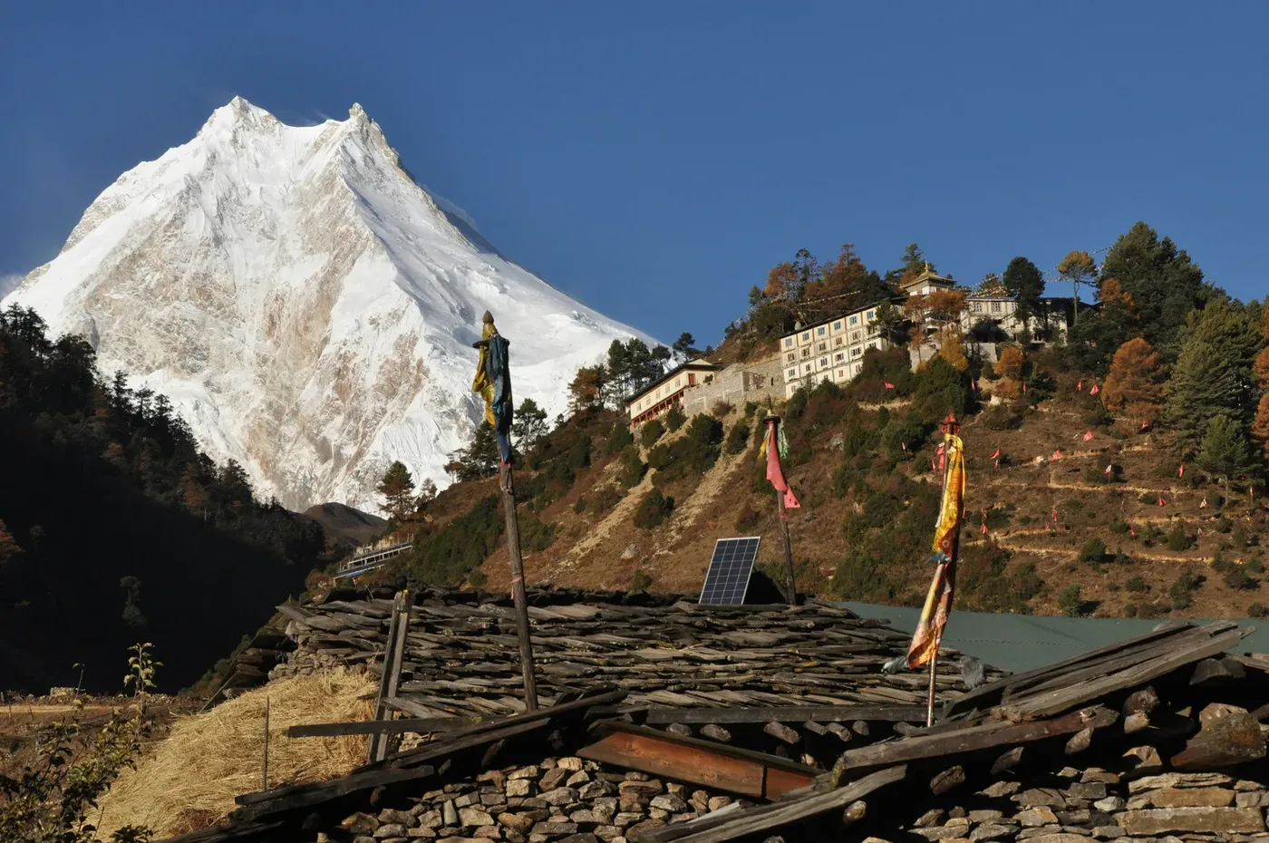
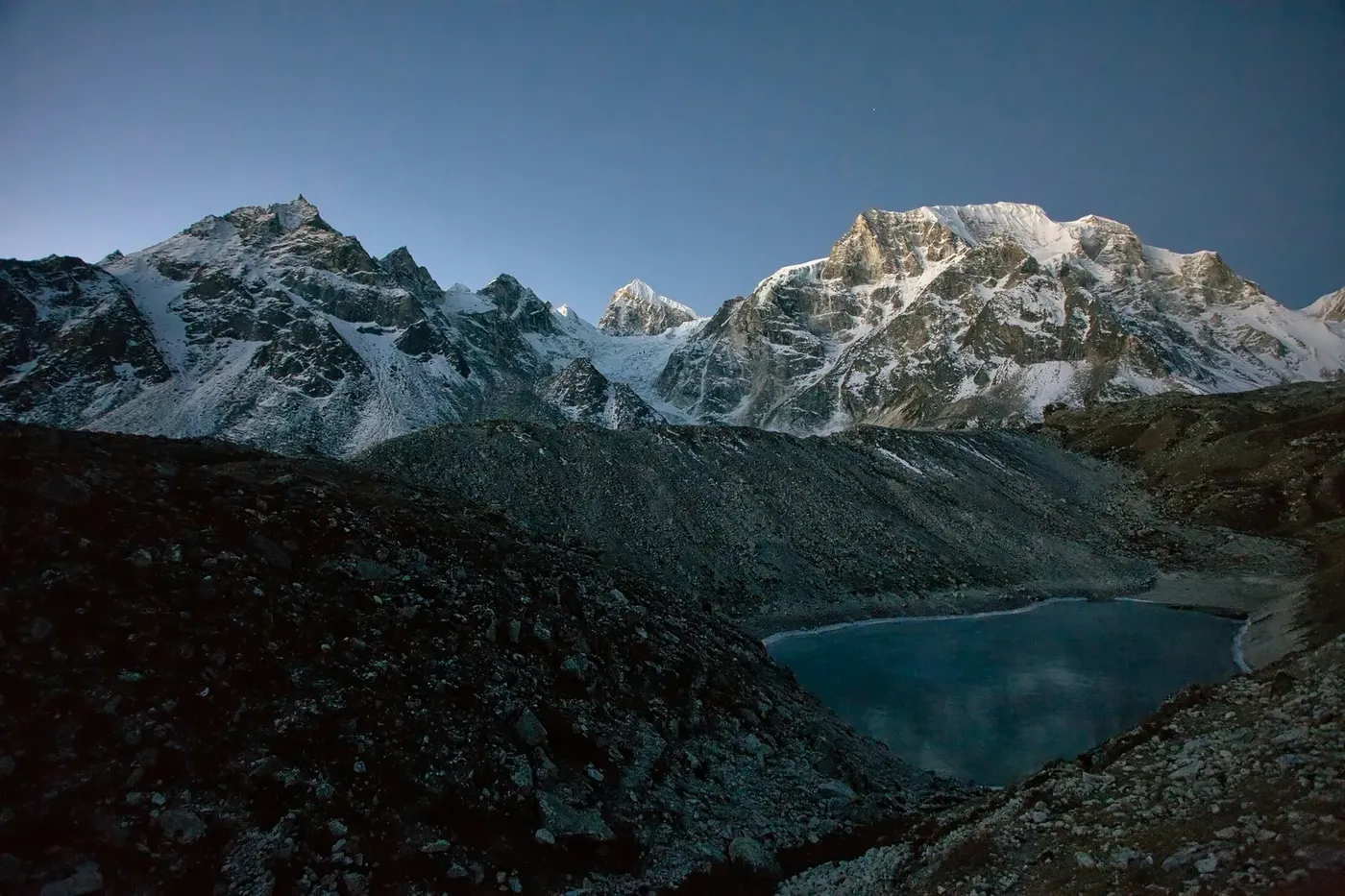
The camp stands on the Manaslu Glacier, at the foot of the south face, inside the Manaslu Conservation Area in west-central Nepal. Above it the mountain rises to 8,163 m, which makes it the eighth highest peak in the world, and the Manaslu entry on Wikipedia is a sensible place to check that headline figure against any operator’s brochure. The face above the glacier is the reason climbers spend six weeks on this mountain: from the ice at its foot, the south wall fills the whole width of the sky, and the scale only resolves when a person walks across the foreground.
What you find at the camp is what an expedition leaves behind at a base camp anywhere in the Himalaya: tents pitched on the glacier, gear stacked and covered, fixed ropes running up onto the slope, and a great deal of silence. There is no shop, no tea house and no shelter for trekkers. Climbers and their support teams occupy the camp in season; trekkers visit for an hour or two, photograph the face, and walk back down. That is the whole experience, and it is enough.
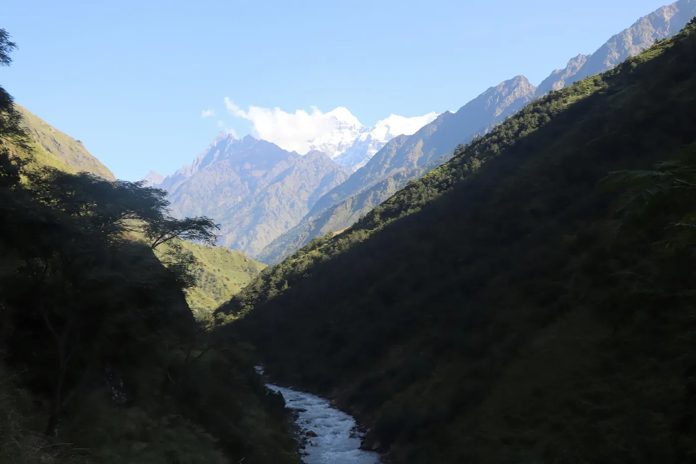
The geography matters because it decides how you get there. The camp is high above the last village, not beside it. Sama Gaun, also written Samagaun, sits at 3,530 m and is the largest settlement on the upper circuit, the place where most groups take their rest day, and the practical base for the walk to the glacier. From the village the route climbs through yak pasture and moraine onto the ice, and the round trip fills a day at walking pace with acclimatisation stops built in. There is no road, no cable car and no shortcut.
It is also worth being precise about what base camp is not. It is not the summit, and nobody walks from it to the top of an 8,000-metre mountain; that is an expedition of weeks with fixed ropes and bottled oxygen, not a trekking day. It is not a helicopter landing site either, and the next section deals with why. And it is not a place you reach on a day tour from Kathmandu, whatever a search result may imply: the nearest road head is days of walking behind you by the time the glacier comes into view.
The base camp day inside the 13-day trek
On the itinerary this site publishes, base camp belongs to Day 7. The walk into Sama Gaun happens on Day 6, a shorter day up from Shyala at 3,575 m, and Day 7 is the acclimatisation day: rest, or the walk to Birendra Lake and Manaslu Base Camp. Doing it in that order is not an accident. The body has just arrived at 3,530 m after climbing steadily from Deng at 1,860 m and Namrung at 2,630 m, and the base camp walk is the first genuinely high ground of the trip. It doubles as acclimatisation for the pass two days later.
The day starts early, because the glacier is at its clearest before the afternoon cloud builds against the face. You leave the village with a day pack, climb steadily through the last pastures, and follow the moraine onto the glacier. The guide sets the pace, which on this day is deliberately slow. Groups that race the climb are the ones who spend the afternoon with a headache, and there is nothing at the camp worth arriving at out of breath for.
| Day | From to | Altitude | What happens |
|---|---|---|---|
| 1 | Kathmandu to Machha Khola | 870 m | Long drive west, rough road on the last stretch |
| 2 | Machha Khola to Jagat | 1,340 m | First day on the trail, subtropical river valley |
| 3 | Jagat to Deng | 1,860 m | Over a rocky ridge into the Budhi Gandaki gorge |
| 4 | Deng to Namrung | 2,630 m | Into the Tibetan-influenced villages |
| 5 | Namrung to Shyala | 3,575 m | Six hours as the valley opens toward the east face |
| 6 | Shyala to Sama Gaun | 3,530 m | Short day into the main village, acclimatisation begins |
| 7 | Sama Gaun rest day | 3,530 m | Walk to Birendra Lake and Manaslu Base Camp |
| 8 | Sama Gaun to Samdo | 3,860 m | Short day through yak pasture toward the Tibetan border |
| 9 | Samdo acclimatisation | 4,750 m high point | Climb high, sleep low, on the Larkya La approaches |
| 10 | Samdo to Dharamsala | 4,460 m | Long, demanding day to the pass base |
| 11 | Larkya La to helicopter exit | 5,160 m | Cross the pass at dawn, then fly out to Kathmandu |
| 12 | Kathmandu | Contingency | Held for weather |
Two alternatives compete for the same rest day, and both are legitimate. Birendra Lake is the shorter and easier option, a glacial lake below the mountain that most people can reach in a half day. Pungyen Gompa is an old monastery on the far side of the valley with a wide view toward the twin peaks above the pass, and it is the quieter choice of the three. If you only have the energy for one, base camp is the one that puts you closest to the mountain; if you want the day to be gentle, the monastery walk gives a better view of the massif as a whole rather than a view from underneath it.
Does a helicopter land at Manaslu Base Camp?
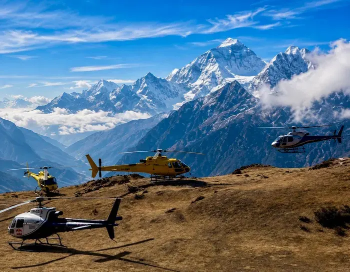
No. No helicopter lands at Manaslu Base Camp, and no operator sells a flight that sets down on the glacier. The reasons are practical rather than regulatory. There is no prepared landing zone on moving glacier ice, the air at that height leaves an aircraft with very little payload margin once fuel, pilot and passengers are counted, and the camp itself is full of tents, ropes and people in season. A landing there would be an unnecessary risk taken for a photograph.
What exists instead is a pair of helipads further up the valley, at Samdo at 3,860 m and at Bimthang at 3,590 m on the far side of the pass. Both are proper landing areas on solid ground, both sit well below 4,000 m, and one of them is where the 13-day trek ends. On our itinerary the helicopter collects you from Samdo or Bimthang and returns you to Kathmandu in a single lift, which is the whole point of the format: the flight is transport out of a roadless valley, not a sightseeing circuit around a summit.
For context on how high commercial flights in Nepal really go: the highest landing this site publishes anywhere in the country is Kala Patthar at 5,545 m, on the one-day Everest Base Camp helicopter tour at $1,260 per person. That is a ridge beside Everest Base Camp, not a summit, and it is exceptional. Manaslu is served at 3,590 to 3,860 m because that is where the ground is flat, the air is thick enough to lift a loaded aircraft, and the valley is wide enough to approach safely. Anyone advertising a Manaslu base camp landing is selling you something that does not exist, and the pattern across the whole country is consistent: aircraft reach high places and land in low ones.
If a landing is the part of a helicopter trip you care about most, the honest move is to choose a route where the landing is the headline. The guide to helicopter landing points in Nepal sets out which sites are real and what each one is used for. Manaslu is not one of them, and pretending otherwise would be the fastest way to ruin a good trek.
Manaslu Base Camp compared with Everest and Annapurna
The three base camps that trekkers actually compare are Everest, Annapurna and Manaslu, and they are not variations on a theme. Everest Base Camp is the highest and the busiest. Annapurna Base Camp is the lowest and the shortest walk. Manaslu is the longest trek to the base camp, the most remote valley, and the one where a helicopter exit changes the trip most, because the walk-out on the far side is three long days to a road.
| Base camp | Camp altitude | Where the helicopter lands on that trek | Published trek and price |
|---|---|---|---|
| Everest Base Camp | 5,364 m | Kala Patthar at 5,545 m on the one-day tour | Everest Base Camp Helicopter Trek, 10 days, $1,840 per person |
| Annapurna Base Camp | 4,130 m | Annapurna Base Camp itself, 4,130 m, on the Pokhara day tour | Annapurna Helicopter Return Trek, 6 days, $1,199 per person |
| Manaslu Base Camp | No surveyed figure published; approach from Sama Gaun at 3,530 m | Samdo at 3,860 m or Bimthang at 3,590 m | Manaslu Helicopter Return Trek, 13 days, $2,160 per person |
Read the table down rather than across. Everest gives you the highest ground and the shortest holiday. Annapurna gives you a landing at the base camp itself, which is why the six-day format works: you walk up, the aircraft puts you down beside the sanctuary, and you are back in Pokhara the same day. Manaslu gives you none of that convenience and all of the emptiness. The circuit is a restricted area, the villages are Tibetan rather than tourist Nepali, and on the upper trail you will pass more yaks than trekkers.
There is one detail worth knowing if you are weighing Manaslu against the other two. Because the camp sits under an 8,163 m face rather than beside a 5,364 m one, the vertical relief at Manaslu is larger, and the glacier approach is longer. Everest Base Camp is a wide, flat, crowded place on the Khumbu Glacier with a viewpoint at Kala Patthar above it. Manaslu Base Camp is narrower, quieter and colder, and the mountain above it is closer to the tents. Photographers tend to prefer it for exactly that reason.
What the base camp day costs you in effort
Base camp is the hardest day of the first half of the trek, and it is worth knowing that before you decide to skip the acclimatisation. The itinerary builds the trip in a deliberate shape: 1,860 m at Deng, 2,630 m at Namrung, 3,575 m at Shyala, then 3,530 m at Sama Gaun where the body gets a full day at altitude. The base camp walk is part of that adaptation. You climb above the village, come back down to sleep low, and the following day moves you to Samdo at 3,860 m. On Day 9 the itinerary reaches a high point of 4,750 m on the pass approaches, again sleeping lower, before Dharamsala at 4,460 m and the Larkya La at 5,160 m.
The result is that the base camp day is doing two jobs at once. It is the payoff for six days of walking, and it is the first real test of how your body handles 4,000 m plus. Treat it as the second thing and the first takes care of itself. Walk slowly, drink more than you think you need, eat lunch even when appetite drops, and turn around if the guide says the weather is closing in. There is no summit to reach and no schedule to beat.
Gear is the other half of the effort question. The walk starts in a village at 3,530 m and climbs onto a glacier, which means the temperature range across one day is wide: sun on the moraine, wind on the ice, and a sharp drop the moment cloud covers the face. A down jacket, gloves, a hat, sunglasses with proper UV rating and boots that are already broken in are not optional. Our trek price includes a down jacket and sleeping bag on request, so nobody needs to buy expedition kit for one day, but boots are personal and should be yours.
Permits and paperwork for a base camp visit
Manaslu is a restricted area, which means the paperwork is more involved than on Everest or Annapurna and you cannot arrange it yourself at a counter in Kathmandu. The Restricted Area Permit is issued only through a registered trekking agency, and a licensed guide is mandatory for the duration of the restricted section. That is one reason the trek is sold as a package rather than as a series of lodges you book as you go.
| Permit | 2026 cost | What it covers |
|---|---|---|
| Restricted Area Permit (RAP) | US$100 for the first 7 days, then US$15 per person per day (September to November) | The restricted corridor itself; issued only through a registered agency |
| MCAP, Manaslu Conservation Area | NPR 3,000, about US$19 | Entry to the Manaslu Conservation Area |
| ACAP, Annapurna Conservation Area | NPR 3,000, about US$19 | The final stretch out through the Annapurna Conservation Area |
| Chumnubri Rural Municipality fee | Collected locally | Municipal charge for the restricted corridor |
In practice the whole block comes to roughly US$250 per person on top of the trek price, and on our 13-day itinerary it is already inside the $2,160: RAP, MCAP, ACAP and the municipal fee are all listed as included, along with the licensed guide, shared porters, twelve nights of teahouse lodging, all trail meals, the helicopter exit and the Kathmandu transfers. What is not included is insurance, which is mandatory and must cover helicopter evacuation above 5,200 m, and tips, which realistically run US$200 to US$280 for the trail.
One point catches people out: the RAP is priced per day, and the day count is set by the number of nights inside the restricted section, not by how many days you feel like walking. A 13-day itinerary sits comfortably inside the standard block. Adding rest days high on the circuit means paying the per-day rate, and September to November is the most expensive season for exactly that reason.
Best season, and how to book from abroad
Autumn is the season to aim for. September to November brings the clearest air and the most stable flight mornings of the year, which matters twice on this trip: once for the views of the face from base camp, and once for the helicopter on exit day. It is also the busiest period and the point at which the RAP rate is at its highest. Spring, March to May, is the second window, with rhododendron on the lower trail and warmer mornings, and a small increase in flight-delay risk as the pre-monsoon build-up begins. Winter, December to February, is quiet and cold, the Larkya La can be snowbound and genuinely difficult, and the permit rate drops. The monsoon months of June to August are not recommended: leeches in the lower gorge, heavy cloud, and narrow flight windows.
For a traveller booking from the United States or Europe, three practical things shape the plan. First, the trip is quoted and paid in US dollars per person on a shared flight, so there is no exchange-rate guesswork and no local cash negotiation on arrival. Second, you should build a buffer around the helicopter day. Weather in the high Himalaya is not a schedule problem you can solve with a better booking; our itinerary carries a contingency day in Kathmandu for precisely this reason, and the last day is departure. Third, insurance is not a formality. Cover has to include helicopter evacuation above 5,200 m, because the highest ground on this trek is the Larkya La at 5,160 m and the whole point of the exit flight is that it happens in a place where walking out would take days.
The booking itself is straightforward once the dates are fixed. You send the dates you want, we confirm whether the valley, the pass and the aircraft can line up, and the permit paperwork is arranged in Kathmandu through the agency before you arrive. There is no online permit portal to fight with and no queue at the conservation office. What you should not do is book a flight and a trek separately from two different companies and hope they meet, because the permit, the guide and the helicopter all have to be arranged by the same licensed operator.
If you are booking from Nepal or India
Travellers already in Kathmandu often ask whether there is a local rate for this trek. On the Everest day tours there genuinely are separate prices for Nepali nationals, but Manaslu is different: the permit is priced in US dollars by the season and the trek is sold per person on a shared flight, so the quote is the same whatever passport you hold. What changes is the logistics around it. From Kathmandu the drive to Machha Khola at 870 m takes most of a day on rough road, and Indian travellers in particular tend to build the trip around a Kathmandu arrival, a day for permits and briefing, and an early start west the following morning.
For Indian pilgrims and travellers, the Manaslu circuit is a mountain trek rather than a darshan trip, and it is worth being clear about that before booking. There is no temple at the end of the walk and no one-day format. The reward is the Budhi Gandaki gorge, the Tibetan villages of Lho and Samagaun, the glacier below the eighth highest mountain in the world and a dawn crossing of the Larkya La. Groups travelling from India usually take the full 13 days and use the helicopter on the way out, which is the format the itinerary is built for.
Mistakes that ruin a base camp day
- Treating base camp as a helicopter destination. It is a walk, and the aircraft lands at Samdo or Bimthang, not on the glacier. Plan the day as a trekking day with a camera, not as a transfer.
- Skipping the acclimatisation day. The camp day is the acclimatisation. Groups that push straight from Sama Gaun to Samdo and then hurry the pass are the ones who suffer above 4,500 m.
- Starting after nine in the morning. Cloud builds against the face through the afternoon, and the glacier is at its clearest early. An early start is the difference between a photograph and a white wall.
- Underestimating the cold. A village at 3,530 m and a glacier in the same day means a wide temperature range. Down jacket, gloves and a hat travel in the day pack, not in the duffel.
- Booking the pass and the flight as separate arrangements. The helicopter exit only works when the permit, the guide and the aircraft are with one operator, because the pickup point is decided by conditions on the day.
Frequently Asked Questions
Where is Manaslu Base Camp?
It sits on the Manaslu Glacier at the foot of the mountain’s south face, inside the Manaslu Conservation Area in west-central Nepal, above the village of Sama Gaun at 3,530 m. The nearest road is days of walking away, which is why the circuit is done as a trek with a guide rather than as a series of independent lodge bookings.
How high is Manaslu Base Camp?
The camp is on the glacier above Sama Gaun, and the approach starts from the village at 3,530 m. We do not publish a surveyed altitude for the camp itself, because the figure varies with where the expedition tents are pitched each season. What the itinerary does record is the village altitude and the 4,750 m high point reached on the Samdo acclimatisation day two days later.
Can you walk to Manaslu Base Camp from Sama Gaun in one day?
Yes, and that is how it is done. It is a full day up to the glacier and back, taken on the rest day in the middle of the circuit, with the morning spent climbing and the early afternoon walking down. Groups leave early because cloud builds against the face later in the day.
Does any helicopter land at Manaslu Base Camp?
No. There is no prepared landing zone on moving glacier ice, and the payload margin at that height is too thin to make a landing worthwhile. Flights in this valley use the Samdo and Bimthang helipads instead, both on solid ground below 4,000 m.
Which landing points do Manaslu helicopter flights use?
Samdo at 3,860 m, on the northern side of the circuit near the Tibetan border, and Bimthang at 3,590 m on the far side of the Larkya La. The 13-day itinerary lifts you out from one of those two, in a single flight back to Kathmandu, and the choice is made by conditions on the day.
Is the base camp day harder than the Larkya La?
No, but it is harder than people expect. The base camp walk is a long day at 3,500 to 4,000 m without a big altitude gain. The pass day is shorter in hours and considerably higher, crossing the Larkya La at 5,160 m before the flight out. Base camp is the training for the pass, not a substitute for it.
Is Manaslu Base Camp worth it, or should I walk to Pungyen Gompa?
They answer different questions. Base camp puts you on the glacier directly under the south face, which is the closest a trekker gets to an 8,163 m mountain. Pungyen Gompa gives a wider view of the massif including the twin peaks above the pass, and it is quieter. If you have the energy for one, base camp is the more physical and more memorable day.
Do I need a special permit to stand at Manaslu Base Camp?
You need the standard Manaslu paperwork, not a separate camp permit. That means the Restricted Area Permit, issued only through a registered agency, plus MCAP and ACAP conservation entries and the local municipal fee, roughly US$250 per person in total, with a licensed guide mandatory throughout the restricted section.
What is the best month for the base camp walk?
October is the strongest single month: clear air, stable mornings and the face at its most visible. September and November are close behind, with November colder and quieter. Spring works too, in March to May, though pre-monsoon cloud starts to interfere with flight mornings as the season advances.
How much does the 13-day Manaslu trek with helicopter exit cost?
$2,160 per person on a shared flight, which includes the permits, licensed guide, shared porters, twelve nights of teahouse lodging, all trail meals, the helicopter out from Samdo or Bimthang and the Kathmandu transfers. Insurance and tips are extra, with tips realistically US$200 to US$280.
Can I book this from the US and pay in dollars?
Yes. The trek is quoted and paid in US dollars per person, so there is no currency negotiation and no cash handling on arrival beyond personal spending. You fix your dates in advance, we confirm them against the season and the aircraft, and the permit paperwork is arranged in Kathmandu before you fly.
What happens if weather stops the helicopter on exit day?
The itinerary carries a contingency day in Kathmandu for exactly this, and there is a walking fallback: the route continues out to the road head at Dharapani at 1,860 m if the aircraft cannot get in. That fallback is the reason the trek is priced and planned as 13 days rather than 11.
The short version
Manaslu Base Camp is a glacier camp under an 8,163 m wall, reached on foot from Sama Gaun at 3,530 m on the rest day of the circuit, and it is the closest a trekker gets to the eighth highest mountain in the world without joining an expedition. No helicopter lands there. The flights that make this trek practical collect you at Samdo at 3,860 m or Bimthang at 3,590 m and return you to Kathmandu in one lift, which turns a three-day walk-out into an afternoon.
If you want the day-by-day route and the full inclusion list, the Manaslu Helicopter Return Trek page is the place to start, and the cost breakdown explains where the $2,160 goes. The circuit trek guide covers the villages and the map, the summit guide explains why nothing lands higher, and the guide to Nepal beyond Everest shows where Manaslu sits against Langtang, Gosaikunda and Rara. If you are still deciding between formats, the trek up and fly back guide lays out the trade honestly.
Send us your dates and we will tell you whether the season, the pass and the aircraft line up. That conversation costs nothing, and on a trek this remote it is the difference between a plan that works and one that spends three extra days walking out.