

Short answer: Manaslu summit stands at 8,163 m, and no helicopter lands there. The highest landing we publish anywhere in Nepal is 5,545 m at Kala Patthar on the Everest Base Camp day tour, and every Manaslu flight we sell puts you down far lower, at the Samdo or Bimthang helipad at the top end of the circuit. What you can buy is the approach: a 13-day Manaslu Helicopter Return Trek from $2,160 per person on a shared flight, which crosses the Larkya La at 5,160 m on foot and lifts you out of the high valley instead of walking three more days back down to the road.
- 8,163 mManaslu summit, the eighth highest mountain in the world
- 5,160 mLarkya La, the highest point reached on foot on our Manaslu trek
- 5,545 mKala Patthar, the highest landing we publish anywhere in Nepal
- $2,160Per person, shared flight, 13-day Manaslu Helicopter Return Trek
Most people who search for the Manaslu summit are not climbers. They are trekkers, photographers or travellers with ten days and a reasonable fear of a two-week walk-out, and what they actually want to know is how close a helicopter can put them to a mountain that is four thousand metres taller than the valley they are standing in. That question has a precise answer, and the answer is made of air density, payload and landing zones rather than marketing.
This guide deals with the summit as a physical place and with the flights that approach it. It covers where the summit sits, why no rotorcraft sets down on it, which landing points in the Manaslu region are real and which are not, what the published alternatives cost, and how a traveller booking from the United States in 2026 should organise the trip so that the mountain, not the logistics, is the memorable part.
Where the Manaslu summit sits, and why the number matters
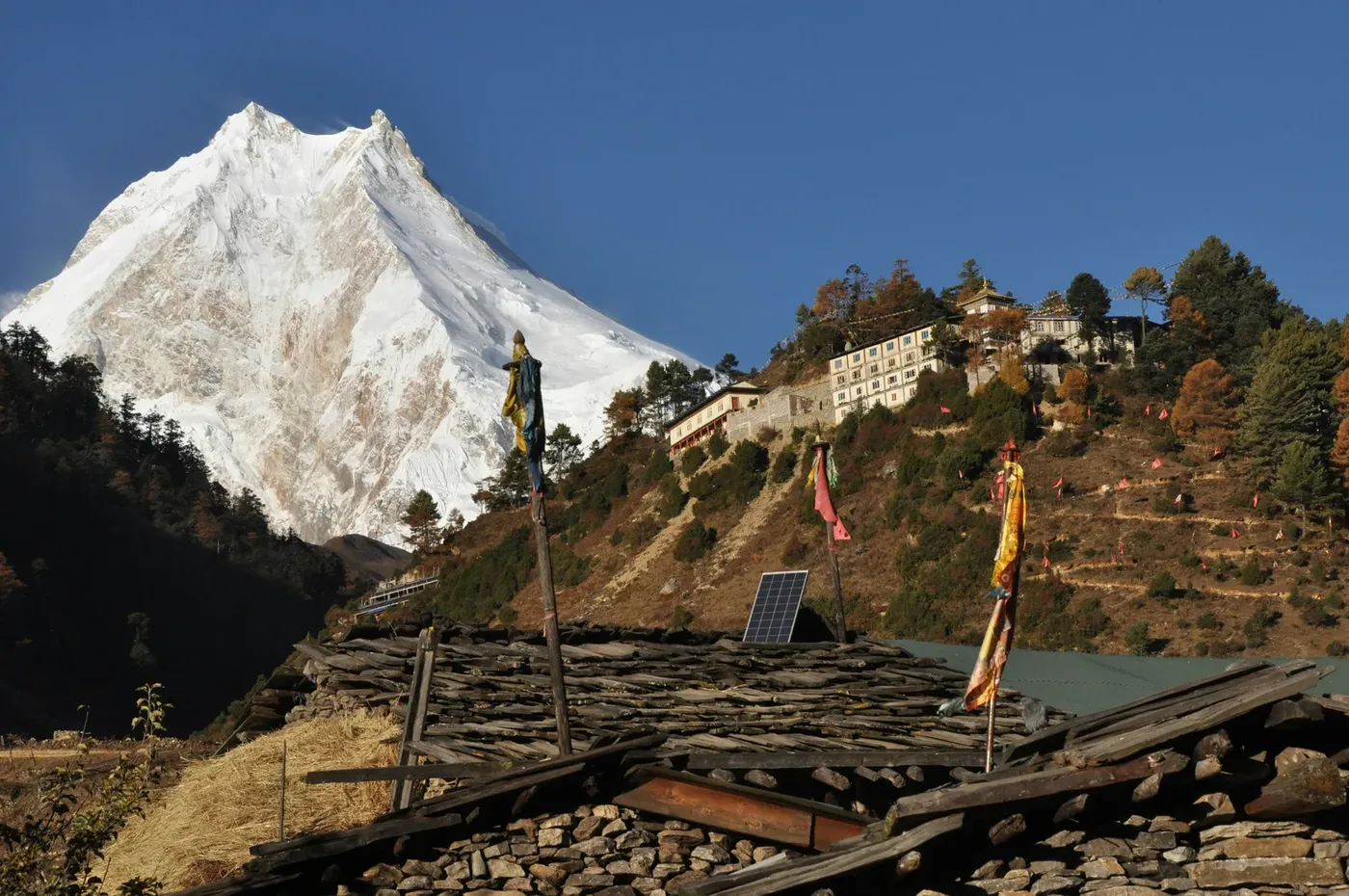
Manaslu is 8,163 m of rock, snow and glacier ice, standing north of Pokhara at the western end of the Annapurna massif and close enough to the Tibetan border that the villages on its northern flank are culturally Tibetan rather than middle-hills Nepali. It is the eighth highest mountain in the world, and the Manaslu entry on Wikipedia is a reasonable place to check the headline figure against any operator’s brochure. The summit is a point on a long ridge, not a dome, which is why the mountain looks different from every village on the circuit: the east face rises above Sama Gaun, the south face fills the sky above the glacier at base camp, and from the Larkya La you are looking at the north-eastern shoulder rather than the peak itself.
Altitude is the number that shapes everything else. At 8,163 m the summit sits in the death zone, where the partial pressure of oxygen is roughly a third of what it is at sea level, and where a fit climber moves in minutes what a trekker covers in an hour. That is the reason the mountain is climbed by expedition and not by tour, and the reason a helicopter can approach it but not settle on it.
For a trekker, the number that matters is not 8,163 m. It is the height of the highest ground you can stand on with your own boots, and on the Manaslu circuit that is the Larkya La at 5,160 m. Our Manaslu Helicopter Return Trek is built around exactly that crossing: eleven days of walking from the road head at Machha Khola to Samdo, the pass on foot at dawn, and then a helicopter out of the high valley instead of the long descent through Bimthang and Tilije.
A helicopter cannot land on the summit, and the reason is physics
Helicopters in the Nepal Himalaya operate on a simple trade: the higher the landing zone, the less weight the aircraft can lift, and the narrower the window in which it can fly at all. A machine that carries five guests and their bags out of Kathmandu at 1,400 m carries far fewer people, and far less fuel, when it is working at 5,000 m and above. Add thin air, a mountain face that offers no flat ground, and the rotor wash that any landing on snow or ice produces, and a summit landing stops being a commercial question and becomes a mountaineering one.
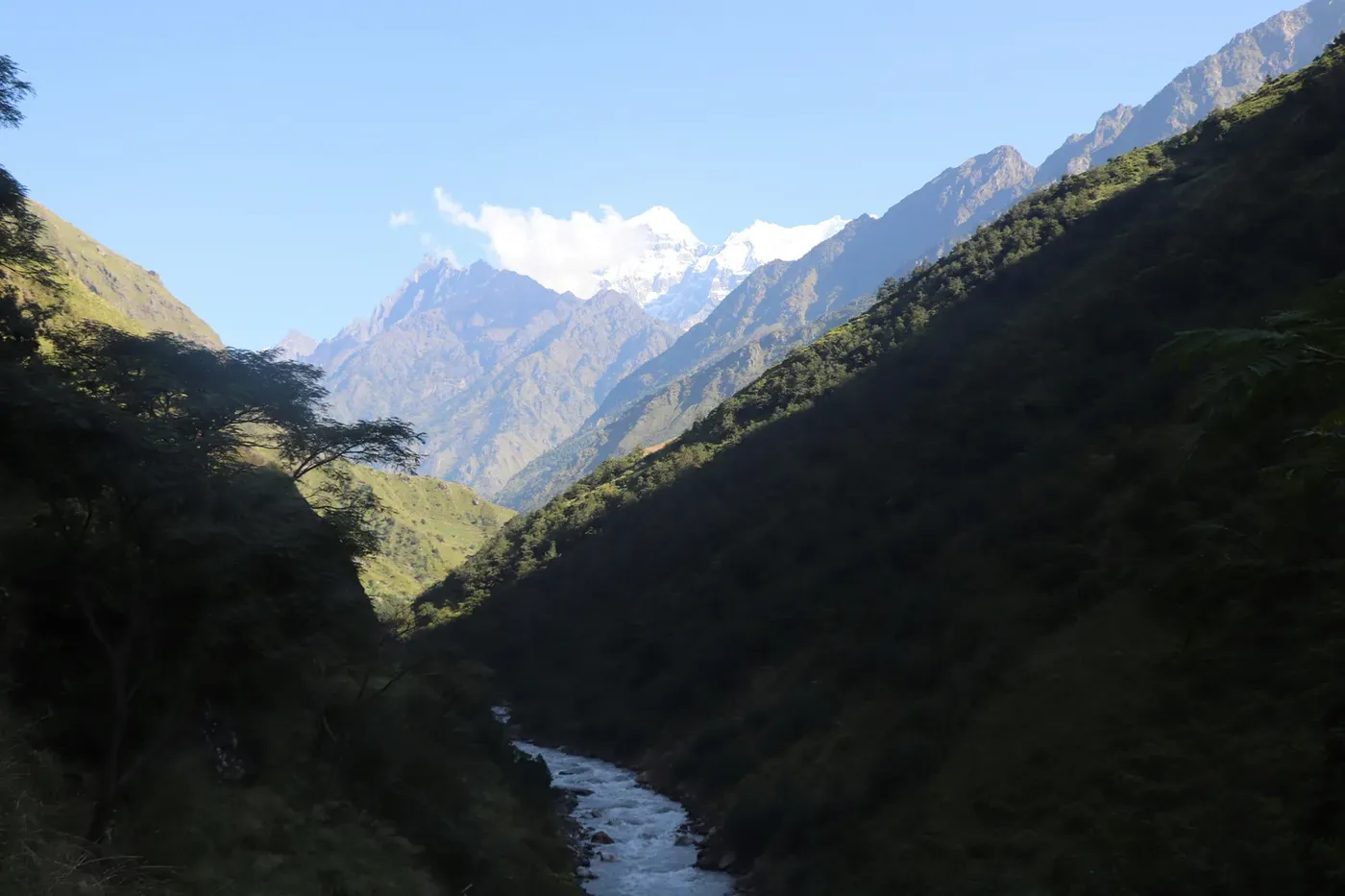
The practical result is that every real landing point in the Nepal Himalaya is a valley floor, a shelf, a pasture, a glacier bench or a purpose-built pad, chosen because a helicopter can sit on it safely and get out again with a load. On the Manaslu circuit the published exit points are the helipads at Samdo, at 3,860 m, and Bimthang, on the western side of the pass. Both were selected for the same reasons: open terrain, a clean departure line, and enough room for the aircraft to set down without the tail rotor near a wall. The full picture of what makes a site usable is in our guide to where a helicopter can land in Nepal.
For scale, the highest landing we publish on any of our own products is Kala Patthar at 5,545 m, on the Everest Base Camp helicopter day tour, and that is a ridge beside Everest Base Camp rather than the summit of anything. Everest itself is 8,848.86 m. No helicopter lands there either. The pattern holds across the range: aircraft reach high places, they land in low ones.
The four published ways to get close to the Manaslu summit
There is no single product called a Manaslu summit tour, so the honest way to plan is to compare the formats we publish side by side. Each one puts you at a different height, over a different number of days, at a different price.
| Option | Highest point you reach | Days | Published price |
|---|---|---|---|
| Manaslu Helicopter Return Trek, trek up and fly out | Larkya La, 5,160 m on foot | 13 | $2,160 per person, shared flight |
| Manaslu Circuit walked both ways | Larkya La, 5,160 m on foot | 14 to 16 | Permits alone run to about US$250 per person on a two-week autumn trek; the extra walking days add lodging and food on top |
| Everest Base Camp Helicopter Trek, for comparison | Kala Patthar, 5,545 m | 10 | $1,840 per person, shared flight |
| Everest Base Camp Helicopter Day Tour, for comparison | Kala Patthar, 5,545 m landing | 1, about 6 hours | $1,260 per person, shared flight |
Two things are worth reading off that table. The first is that the Manaslu product is the longest and most expensive of the four, and the reason is permits rather than rotor time: Manaslu is a restricted area, and the restricted-area permit is charged in US dollars by the day. The second is that a helicopter day tour can put you higher on a mountain than a thirteen-day trek does. That is not a contradiction, it is a statement about geography: Kala Patthar is a ridge you can land on, and the Larkya La is a pass you have to walk to.
If your only objective is altitude bragging rights, the Everest day tour wins on paper. If your objective is the Manaslu massif, the culture of the Budhi Gandaki valley and a genuine crossing of a 5,160 m pass, the thirteen-day trek is the only product in the list that delivers it. The price difference between them, roughly nine hundred dollars, buys eleven days of walking, twelve nights in teahouses, all trail meals, a guide and porter, and the permits for a restricted area. The flight home from the high valley is the same kind of flight in both cases.
Manaslu landing points, from the helipad to the summit ridge
Operators use the word landing loosely, so here is the circuit laid out by height, with an honest note on how each point is reached. If a number is not published on our own pages, we have left it out rather than guess at it.
| Point on the route | Altitude | How you reach it | Helicopter landing |
|---|---|---|---|
| Samdo helipad | 3,860 m | Walked, day 8 of the trek, the last village before the pass | Yes, the published exit point |
| Bimthang helipad | Not published on our route pages | Walked, on the western side below the pass | Yes, the alternative exit point |
| Larkya La | 5,160 m | Walked, the pass day, pre-dawn start | No, crossed on foot |
| Manaslu Base Camp | Walked from Sama Gaun, a full day up to the glacier | On foot only | No |
| Manaslu summit | 8,163 m | Climbing expedition, weeks of staging and acclimatisation | No |
The distinction between Samdo and Bimthang matters more than it looks. Samdo is the high village on the northern side, and flying out from there means you skip the pass crossing entirely, which is the right choice for a group that is behind schedule, unwell or short of a weather window. Bimthang sits on the far side, so a flight from there means the group has already crossed the Larkya La on foot and is being lifted out of the descent. Both options are used on the same itinerary depending on how the group is pacing and on what the morning looks like. Our Manaslu circuit trek guide walks through the day-by-day decisions in more detail.
Manaslu Base Camp is the point most people confuse with the summit. It is reached on foot from Sama Gaun at 3,530 m, on the rest day in the middle of the circuit, and it is a full day up to the glacier where expedition tents sit on the ice below the south face. Standing there, the face above fills the width of the sky. It is a serious, cold place, and it is about as close as a trekker gets to the mountain without joining an expedition. Nobody walks from base camp to the summit, and nobody flies to it either.
The summit itself: an expedition, not a day tour
Climbing Manaslu is a different sport from anything described above. It involves a permit of its own, a climbing crew, fixed rope on the upper mountain, camps stacked up the glacier and a summit window that opens, if it opens at all, in the autumn or the pre-monsoon spring. Climbers spend weeks moving up and down the mountain to acclimatise before they attempt the top, and helicopter support in that world means moving loads and people to and from base camp, not sightseeing at 8,000 m.
Travellers often ask whether they can fly to the summit for a photograph. The answer is no, and the reason is not regulatory caution but the aircraft itself: at 8,163 m a helicopter has almost no margin for payload or manoeuvre, and there is no ground on the summit ridge to land on. The top of this mountain is a place you climb to, on foot, on a rope, with a team.
What a helicopter can do is compress the approach to the flanks, and that is a genuine and underrated use. Flying into the upper valley, or lifting out of it, removes days of walking that would otherwise be spent on the least interesting part of the route. It does not change the height of the mountain. It changes how much of your holiday is spent getting to it.
What the Manaslu summit looks like from a helicopter window
On the eastern approach the aircraft runs up the Budhi Gandaki drainage with the massif ahead and to the left, and the first thing passengers notice is how continuous the ridge looks: one wall of ice and rock with the summit somewhere along the top of it, not a single cone standing apart. The second thing they notice is scale. Villages that took a day to walk past are suddenly the size of a thumbnail, and the gorge that consumed three days of the trek is a fold in the ground below the skids.
The best light is early. Mountain flying in Nepal concentrates in the morning because the valleys fill with convective cloud by late morning, and because the low sun rakes the faces and puts texture into snow that looks flat at midday. Any photograph you have seen of Manaslu with a sharp, sculpted east face was taken before the cloud built. That is also the reason flight schedules are front-loaded: the window is real, and it closes.
For travellers who want the summit in the frame rather than under their boots, the practical combination is a flight that lands at Samdo or Bimthang and a night or two at Sama Gaun, so that the mountain is seen at dawn from the valley floor with the face lit and no aircraft noise. That is the view most people actually came for, and it costs nothing beyond the days on the trail.
Booking Manaslu from the United States in 2026
Almost every enquiry we take from North America arrives with the same three questions: what does it cost in dollars, how do I pay from abroad, and when should I come. The answers are straightforward, but the sequence matters.
Price and currency. Our Manaslu Helicopter Return Trek is published at $2,160 per person on a shared flight, and the price is quoted in US dollars. That figure includes the permits, a licensed guide, porters, twelve nights of teahouse lodging, all trail meals, the helicopter exit and the Kathmandu transfers. It does not include international airfare, Kathmandu hotels, tips or insurance, and the insurance point is not optional: the policy has to cover helicopter evacuation above 5,200 m, because that is the altitude band the pass crossing sits in.
How booking works from abroad. You send your dates, the number of travellers and passport copies. We confirm the aircraft, the slot and the price in writing, and the permits are issued through our registered agency, which is the only route by which a restricted-area permit can be issued at all. You do not queue at a counter in Kathmandu for this, and neither does your hotel. Once the permit is issued the departure date is effectively locked, which is why passport details are requested early.
When to come. Late September to November is the season we recommend, and the permit pricing reflects it: the restricted-area permit costs US$100 for the first seven days plus US$15 per person per day from September to November, against US$75 for the first week plus US$10 per day from December to August. Autumn gives clear mornings, stable air and the best chance of a clean pass crossing. Winter is cheaper on permits and much colder on the trail, and the summer monsoon clouds the valleys and closes the flying windows that the whole plan depends on.
Build a buffer day. The single most common planning mistake made by travellers from far away is arriving, trekking, flying out and boarding an international flight in the same 36 hours. Himalayan flying is weather-dependent, and a closed morning moves everything by a day. One spare day in Kathmandu before your flight home costs a hotel night and saves the trip. Our season and timing guide sets out the month-by-month picture.
What the permits cost before you reach the mountain
Manaslu is a restricted area, and that single fact explains most of the price gap between this trek and Annapurna or Everest. Three permits and one local fee apply, and the restricted-area permit is charged in US dollars per day rather than as a flat fee.
| Permit or fee | 2026 cost | How it is issued |
|---|---|---|
| Restricted Area Permit, September to November | US$100 for the first 7 days, then US$15 per person per day | Only through a registered trekking agency |
| Restricted Area Permit, December to August | US$75 for the first 7 days, then US$10 per person per day | Only through a registered trekking agency |
| MCAP, Manaslu Conservation Area | NPR 3,000, about US$19 | Conservation area entry |
| ACAP, Annapurna Conservation Area | NPR 3,000, about US$19 | Conservation area entry for the western exit |
| Chumnubri Rural Municipality fee | Collected locally | Municipal charge for the restricted corridor |
For a two-week autumn trek the permit block works out at roughly US$250 per person: about US$205 for the restricted-area permit and about US$19 each for MCAP and ACAP, with the municipal fee collected on the ground. A licensed guide is mandatory in the restricted area, and since March 2026 solo trekkers are permitted, which removed the old two-person minimum but left the guide requirement in place.
This is the paragraph to keep in mind when comparing quotes. A Manaslu price well below the permit floor is either excluding permits or not entering the restricted area at all. Ask which permits are inside the number before you compare two totals, and ask whether the helicopter exit is a shared seat or a private aircraft, because those two things are not the same purchase.
If you are booking from Kathmandu, India or the Gulf
Travellers already in Nepal, and the many Indian and Gulf-based visitors who book a Nepal helicopter trip on a short break, tend to approach this differently: they are closer, they have less lead time, and they often want one specific flight rather than a two-week trek. Two practical points apply to them.
First, the conservation fees are denominated in Nepali rupees, at NPR 3,000 each for MCAP and ACAP, while the restricted-area permit is a US dollar charge that applies to the restricted corridor regardless of where the traveller is booked from. Second, the guide and agency rule does not bend for local bookings: the restricted-area permit is issued only to a registered trekking agency, so a hotel in Kathmandu cannot arrange it and a walk-in at the counter cannot buy it. Booking through a licensed operator is the mechanism, not a mark-up.
For Indian pilgrims the more natural fit is usually a different product entirely. The Muktinath helicopter pilgrimage flies to the temple at 3,710 m and back in a day at $1,080 per person, and it is the flight most often booked from India for darshan. Manaslu is a trekking and climbing destination, not a pilgrimage circuit, and it rewards people who can give it a week and a half rather than a weekend.
The helicopter exit day, step by step
The morning of the flight is the part of the itinerary that clients ask about most, so here is the sequence as it actually runs. The group is weighed with bags, because payload limits above 4,000 m are strict and the published allowance is 10 kg per person plus a day pack. The pilot briefs boarding, door discipline and rotor clearance. The aircraft departs in the first clear window after sunrise, and flying time from Samdo or Bimthang to Kathmandu is roughly 25 minutes.
Multiple lifts are used when the group is larger than the high-altitude seat count of the aircraft, and you will know your slot the evening before. If the window closes, you fly the next morning and spend an extra night in the village, which is exactly why the itinerary carries a contingency day in Kathmandu. Our Manaslu cost breakdown covers what that extra night does to the budget.
Common mistakes, and how to avoid them
Four mistakes account for most of the disappointment we see on this route. None of them is exotic, and all of them are avoidable with a little planning.
- Booking a summit flight. If an operator offers to land you on the Manaslu summit, the offer is not real. Ask for the landing point by name and altitude before you pay anything.
- Leaving no weather buffer. A single closed morning can cascade into a missed international flight. One spare day in Kathmandu is the cheapest insurance in the itinerary.
- Comparing totals instead of contents. A quote that excludes permits, insurance or the shared helicopter exit is not cheaper, it is smaller. Read the four lines: aircraft, permits, ground handling, extras.
- Underestimating the pass day. The Larkya La is a long day at 5,160 m, starting before dawn. The helicopter removes the descent, not the climb, and the training should be the same as for the full circuit.
Frequently asked questions
Can a helicopter land on the Manaslu summit?
No. The summit is 8,163 m, there is no ground to land on, and an aircraft at that altitude has almost no payload margin. The highest landing we publish anywhere in Nepal is Kala Patthar at 5,545 m on the Everest Base Camp day tour, and Manaslu flights land at the Samdo or Bimthang helipads, both well below 4,000 m.
Where does a helicopter land on the Manaslu circuit?
At Samdo, 3,860 m, on the northern side of the pass, or at Bimthang on the western side. Both are used on the same itinerary depending on the pace of the group and the weather. Samdo skips the pass crossing; Bimthang means the group has already crossed the Larkya La on foot.
How close can I get to Manaslu summit without climbing?
Two places. Manaslu Base Camp, reached on foot from Sama Gaun at 3,530 m on the rest day, puts you on the glacier below the south face. The Larkya La at 5,160 m is the highest ground on the circuit and gives you the north-eastern shoulder of the massif. Neither is the summit, and both are considerably more impressive than a photograph suggests.
How much does the Manaslu Helicopter Return Trek cost?
$2,160 per person on a shared flight for 13 days, including permits, a licensed guide, porters, twelve nights of teahouse lodging, all trail meals, the helicopter exit and Kathmandu transfers. International flights, Kathmandu hotels, tips and insurance are extra.
Do I need a permit to fly in the Manaslu region?
You need permits to be in the region at all. The restricted-area permit costs US$100 for the first seven days then US$15 per person per day from September to November, or US$75 then US$10 per day from December to August. MCAP and ACAP are NPR 3,000 each. The restricted-area permit is issued only through a registered trekking agency, and a licensed guide is mandatory.
Can I see the Manaslu summit from the helicopter?
Yes, and it is the best view of the mountain you will get without climbing it. On the eastern approach the aircraft runs up the Budhi Gandaki drainage with the massif ahead, and the summit ridge reads as a continuous wall of ice and rock. Morning is the only reliable window, before the valleys fill with cloud.
Is a helicopter flight to Manaslu safe at that altitude?
Mountain flying in Nepal is routine for the operators who do it daily, and it is also the most weather-sensitive part of any itinerary. Flights run in the morning, payload is reduced at altitude, and landings happen at prepared sites. The honest risk is not the aircraft, it is the schedule: weather cancels flights, and a good operator rebooks you rather than pushing a marginal window.
When is the best time to book for Manaslu summit views?
Late September to November. The air is clearest, the mornings are stable, and the permit season pricing reflects the demand. December to August is cheaper on permits but colder on the trail, and the monsoon months close the flying windows the plan depends on.
What is the highest helicopter landing in Nepal?
On our published products it is Kala Patthar at 5,545 m, on the one-day Everest Base Camp helicopter tour from Kathmandu at $1,260 per person. Other operators land at other sites, but no commercial helicopter lands on an 8,000 m summit.
How fit do I need to be for the Manaslu trek with a helicopter exit?
The same fitness as the full circuit. The helicopter replaces the descent, not the ascent, so you still walk eleven days and cross a 5,160 m pass, with an eight to nine hour pass day. Train as if there were no helicopter, because for the first eleven days there is not.
Can I book from the US and pay in dollars?
Yes. The trek is priced in US dollars, the booking is confirmed in writing with your dates and aircraft, and permits are issued through our registered agency once passport copies are received. Payment is arranged at booking, and the departure is locked when the restricted-area permit is issued.
What happens if the helicopter cannot fly on exit day?
You stay in the village, keep your room, and fly the next morning. Weather cancellations move a minority of pickups in peak season and no one is stranded, because the landing points are teahouse villages rather than remote camps. The itinerary carries a contingency day in Kathmandu for exactly this reason.
The honest summary
The Manaslu summit is not a destination you can buy a seat to. It is the top of the eighth highest mountain in the world, reached on foot by climbers with weeks to spend, and the closest a helicopter gets is a valley floor at 3,860 m or a helipad on the far side of the pass. What you can buy is the best approach to the mountain that exists for a traveller with a fortnight: eleven days of walking through a restricted valley, a dawn crossing of the Larkya La at 5,160 m, and a 25-minute flight out that deletes three days of descent.
That is the trade, and it is a good one. Start with the Nepal beyond Everest guide if you want to see how Manaslu sits alongside Langtang, Gosaikunda and Rara, then read the Manaslu Helicopter Return Trek page for the day-by-day route and the price. If you are still deciding between formats, the comparison of a trek up and fly back against a pure day tour will settle it quickly.
Send us your dates and we will tell you honestly whether the mountain, the weather and your calendar line up. That conversation costs nothing, and it is the difference between a trip that photographs well and one that actually works.